
Prellenkirchen
|
market community Prellenkirchen
|
||
|---|---|---|
| coat of arms | Austria map | |
 |
|
|
| Basic data | ||
| Country: | Austria | |
| State : | Lower Austria | |
| Political District : | Bruck an der Leitha | |
| License plate : | BL | |
| Surface: | 41.54 km² | |
| Coordinates : | 48 ° 5 ' N , 16 ° 57' E | |
| Height : | 178 m above sea level A. | |
| Residents : | 1,618 (January 1, 2020) | |
| Postal code : | 2472 | |
| Area code : | 02145 | |
| Community code : | 3 07 19 | |
| NUTS region | AT127 | |
| Address of the municipal administration: |
Hauptplatz 7 2472 Prellenkirchen |
|
| Website: | ||
| politics | ||
| Mayor : | Johann Köck ( ÖVP ) | |
|
Municipal Council : ( 2020 ) (19 members) |
||
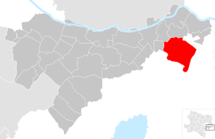
| Location of Prellenkirchen in the Bruck an der Leitha district | ||
  |
||
| Source: Municipal data from Statistics Austria | ||

Prellenkirchen is a market town with 1618 inhabitants (as of January 1, 2020) in the Bruck an der Leitha district in Lower Austria .
geography
Prellenkirchen is located in the industrial district in Lower Austria. The market municipality covers 41.54 square kilometers, making it the second largest municipality in the district in terms of area. About five and a half percent of the area is forested.
Community structure
The municipal area comprises four cadastral communities or three localities (area 2016; inhabitants: as of January 1, 2020):
- Deutsch Haslau (703.91 ha), Deutsch-Haslau (347 Ew.)
- Prellenkirchen (2,780.39 ha, 1075 Ew.)
- Schönabrunn (449.01 ha, 196 Ew.)
- Wangheim (223.26 ha)
history
In ancient times the area was part of the province of Pannonia .
In the course of the construction of the north-east A 6 motorway, an early Bronze Age burial ground , a Celtic settlement and remains from the migration period were found during the rescue excavation by the Federal Monuments Office at the Prellenkirchen site .
Population development
According to the results of the 2001 census, there were 1285 inhabitants. In 1991 the market town had 1266 inhabitants, in 1981 it had 1226 and in 1971 it had 1181 inhabitants.
economy
In 2001 there were 47 non-agricultural workplaces, and according to the 1999 survey there were 130 in agriculture and forestry. According to the 2001 census, the number of people in employment in the place of residence was 556. In 2001, the employment rate was 44 percent.
Culture and sights

- Parish Church of the Holy Spirit: The church was badly damaged during the 5th Austrian Turkish War (1683), then largely rebuilt in Baroque style and consecrated in 1744. The church with a high western tower is located in an elevated position on the eastern edge of the village and is surrounded by a cemetery and a quarry stone wall.
- Prellenkirchen in the state survey around 1873

Prellenkirchen and Schönabrunn

Deutsch Haslau on the border with what was then Hungary with Potzneusiedl


politics
The municipal council has 19 members. Since the municipal council elections in Lower Austria 2020 , the municipal council has the following distribution:
- 15 ÖVP
- 4 SPÖ
- mayor
- Johann Köck (ÖVP)
Web links
- 30719 - Prellenkirchen. Community data, Statistics Austria .
- www.prellenkirchen.at Website of the market town of Prellenkirchen
Individual evidence
- ↑ Federal Office for Metrology and Surveying, Regional Information, deadline December 31, 2016, accessed on February 19, 2018
- ↑ Statistics Austria: Population on January 1st, 2020 by locality (area status on January 1st, 2020) , ( CSV )
- ^ Dehio manual. The art monuments of Austria: Lower Austria south of the Danube. Part 2. M to Z. Bundesdenkmalamt (editor), Verlag Berger, Horn / Vienna 2003, ISBN 3-85028-365-8 , page 1736f.
- ^ Mayor Prellenkirchen: Prellenkirchen . In: Prellenkirchen . ( prellenkirchen.gv.at [accessed on November 12, 2018]).

Au am Leithaberge | Bad Deutsch-Altenburg | Mountain | Bruck an der Leitha | Ebergassing | Enzersdorf an der Fischa | Fischamend | Göttlesbrunn-Arbesthal | Götzendorf an der Leitha | Gramatneusiedl | Hainburg an der Donau | Haslau-Maria Ellend | Himberg | Hof am Leithaberge | Höflein | Hundsheim | Klein-Neusiedl | Lanzendorf | Leopoldsdorf | Mannersdorf am Leithagebirge | Maria-Lanzendorf | Moosbrunn | Petronell-Carnuntum | Prellenkirchen | Rauchwarth | Rohrau | Scharndorf | Schwadorf | Schwechat | Summer one | Trautmannsdorf an der Leitha | Wolfsthal | Twelve axing
Cadastral communities: Deutsch Haslau | Prellenkirchen | Schönabrunn | Wangheim
Locations: Deutsch-Haslau | Prellenkirchen | Schönabrunn
Market place: Prellenkirchen Villages: Deutsch-Haslau | Schönabrunn Other locations: Wangheim
Counting district: Prellenkirchen | German Haslau | Schönabrunn