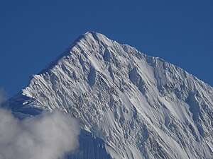
Gangapurna
| Gangapurna | ||
|---|---|---|
|
Gangapurna as seen from Thorang-Phedi. |
||
| height | 7455 m | |
| location | Districts Kaski , Manang ( Nepal ) | |
| Mountains | Annapurna Himal ( Himalaya ) | |
| Dominance | 3.42 km → Annapurna III | |
| Notch height | 563 m | |
| Coordinates | 28 ° 36 '18 " N , 83 ° 57' 48" E | |
|
|
||
| First ascent | May 5, 1965 by Günter Hauser , Erich Reismüller, Hermann Köllensperger, Ludwig Greißl, Ang Tempa and Phudorje II over the southern flank. | |
| Normal way | East ridge of the Manang valley | |
|
Annapurna III and Gangapurna |
||
The Gangapurna ( nepali : Gangapurna ) is a seven-thousand in the Himalayas in Nepal . At 7455 m , Gangapurna is the 57th highest mountain on earth .
Surname
Gangapurna is a double word from Sanskrit , the name of the mountain is made up of ganga (a goddess in Hindu mythology who brought holy water to earth) and purna (filled with) . Gangapurna can therefore be called "The water-giving goddess". The name, which came from the local population, was already mentioned in specialist literature until 1965, but it was only after the first ascent was it finally accepted by the Nepalese government. The name is also feminine in German .
Location and topography
The Gangapurna is a mountain in the Annapurna Himal . This mountain range extends in a west-east direction and consists of several independent mountains. The Gangapurna is a central summit in the main ridge of the Annapurna I ( 8091 m ) leading from the west and forms a shapely summit pyramid above the village of Manang in the north. Annapurna III ( 7555 m ) is located in the immediate vicinity to the south-east, separated by a 6892 m high notch . The Gangapurna glacier ends in the north with an imposing icefall in the Manang Valley.
First ascent
The first ascent of the Gangapurna was achieved by a team of mountaineers led by the expedition leader Günter Hauser as part of the first German Himalayan expedition after the Second World War . On April 6, 1965, the expedition reached the base camp at the end of Modi Khola at 3750 m . The route continues over the Eastern Annapurna Glacier to the foot of the southern flank of the Gangapurna. This 450 meter high and up to 55 ° steep ice wall was finally climbed on May 5, 1965 and camp 5 was set up in the 6892 m high gap between Gangapurna and Annapurna III. On May 6, 1965, the summit could be climbed via the east ridge. The team included Günter Hauser, Erich Reismüller, Hermann Köllensperger, Ludwig Greißl, Ang Tempa ( Sirdar ) and Phudorje II. It is remarkable that two days later the remaining four German participants Klaus Ekkerlein, Hermann Wünsche, Otto Seibold, KH Ehlers and the Sherpa Pemba Norbu also stood at the summit.
literature
- Günter Hauser : Ice peaks and gold pagodas. Expedition to the Kingdom of Nepal. Bruckmann, Munich 1966.
Web links
- Gangapurna on Peakbagger.com (English)
- Gangapurna at Peakware (English)
- Gangapurna (7455m) rising above Manang at summitpost.org
- Map of the Annapurna Himal on www.digitalhimalaya.com, a site of the University of Cambridge
- Klaus Ekkerlein: Gangapurna, Glacier Dome and Tent Peak. In: American Alpine Journal 1966, pp. 191f. (AAJO, English)
- Himalayaguides.com - Gangapurna Expedition (English)
swell
- Yearbook of the German Alpine Club 1966: German Himalaya Expedition 1965 , Alpiner Verlag Fritz Schmitt, Munich 1966.


