Waters in Leipzig
Waters in Leipzig are the rivers Weisse Elster , Pleiße and Parthe , which form an inland delta in the area of the city , as well as numerous streams around which the Leipzig floodplain forest landscape emerged. For economic use, for the defense of the city and for flood protection, many of these rivers have been diverted, channeled or drained, and ditches and canals have also been rebuilt.
A large number of ponds and lakes have also been created or created in Leipzig for fish farming, for urban planning reasons or as a result of mining.
Rivers, mill and raft ditches
The rivers Pleiße, Parthe and Weisse Elster, which flow together in the Leipzig area, shaped the development of the city early on. In the course of Leipzig's city history, its river beds have been relocated and for the most part channeled.
The rivers were used to transport timber as early as the Middle Ages. From the 15th century on, canals were built through which firewood and split logs were floated into the city to supply the city. The most important canal for Leipzig was the Elsterfloßgraben , through which most of the firewood required in the city was transported to the raft place.
The water to drive the Leipzig mills was conducted over mill ditches, for example over the Pleißemühl ditch to the nun mill , to the Thomas mill and to the barefoot mill and over the Elstermühl ditch to the Angermühle .
From the end of the 18th century, river bathing also became popular, so that in the heyday of the 19th century there were more than 25 river baths in Leipzig and in the incorporated suburbs, before the pollution finally came to an end as a result of increasing industrialization in the first third of the 20th century the Leipzig river baths meant.
Pleiße
The Pleiße originally divided into two natural arms in the area of today's Connewitz Pleißen flood weir: from there, the Rödel flowed first northwest and later north west of today's Nonnenweg and flowed west of the Klingerweg into the Elster, around the boathouse of the canoeing department of the SC DHfK Leipzig . From around 1880 the Rödel branched off from the newly built Elster flood bed, the inflow from the Pleiße was cut off. After that it had little water and was filled in in 1926/27.
The eastern arm , later known as Alte Pleiße and then Kuhstrangwasser , flowed from the Connewitz weir through the floodplain to its confluence with the Elster in the area of today's Schreberbad. It was backfilled in 1879.
In 1287, the Nonnenmühlgraben was created from the area of today's Connewitz weir to today's Harkortstrasse to supply the Leipzig nunnery. Together with parts of the Thomas and Barfußmühlgräben that had already been created, it now forms the Pleißemühlgraben, which took up the main part of the Pleißewasser and was therefore generally referred to as the Pleiße together with the Gohliser Mühlgraben and the old bed of the Nördliche Rietzschke until the 20th century . Due to its location directly west of the former city moat and the relocation of the Parthe from the northern city limits further north to its current bed, it has become common to see Leipzig as a city on the Pleiße.
Until the middle of the 19th century, the Elster-Pleiße-Aue was regularly inundated by floods. Following a project by the Leipzig hydraulic engineers Kohl and Georgi from 1852 to 1854, the flood management of the Elster and the Pleiße was subsequently changed. For the splices was splices flood bed from Connewitzer defense applied to the magpie in the area of today's Palm Garden weir, later on in the Leipziger Eck the Elster flood was involved and from there since then so is.
In addition, there were two Pleisse high flood beds in the Leipzig area : on the one hand, the one that still exists north-east of the wildlife park and another from today's Primavesistraße to the Weißen Elster south of today's Pohlestraße.
From around 1915, the Pleiße was heavily polluted by the discharge of untreated industrial sewage, so that the Pleißemühlgraben in the inner city area between 1951 and 1956 was vaulted up to the Natural History Museum and the northern section from there up to the confluence of the Parthe in the zoo was filled in. Since then, the water of the Pleißemühlgraben has been flowing via a short cross channel at the former location of the Angermühle into the Elstermühlgraben, which from there is the former natural bed of the Parthe.
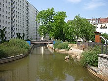
After protests by the citizens' movement in 1989 about the pollution of the Pleiße and the collapse of many industrial companies in the Pleiße catchment area, the inner-city mill ditches have been gradually reopened since 1992.
After the completion of the corresponding projects, large parts of Leipzig should be navigable with pleasure boats.
All Leipzig rivers are (as of 2018) in poor condition according to the European Water Framework Directive .
Shipping canals and port
The plans to build a canal to the Mulde or Elbe from Leipzig date back to the 17th century. Around 1850, Karl Heine took up the idea of creating an artificial waterway with a connection to the Elbe. From 1856 to 1896, the Karl-Heine Canal was built first, followed by the Elster-Saale Canal from 1933 to 1943, which ends at Günthersdorf 8 km before the Saale. Both canals are to be connected to one another via the Lindenau harbor . The passage from the Karl Heine Canal was completed in July 2015.
Lakes
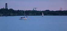
The best-known and oldest lakes in the Leipzig urban area are the Kulkwitzer See on the south-western edge of Leipzig ( Miltitz , Grünau , Lausen ) on the border with Markranstädt and the Auensee in Wahren , which was Germany's largest entertainment establishment from 1914 to 1932 with the Luna Park . There are other lakes with the Cospudener See also in the south-west of Leipzig on the border with Markkleeberg , in the south in the district of Leipzig and in the north in the district of North Saxony . Most of them were created through the recultivation of old open-cast mining areas. Together they form the Leipziger Neuseenland .
See also
Web links
Individual evidence
- ↑ Lakes, rivers and bodies of water: Worth knowing. In: leipzig.de. Retrieved May 25, 2017 .
- ^ Horst Riedel: Stadtlexikon Leipzig from A to Z. Pro Leipzig, Leipzig 2005, ISBN 3-936508-03-8 , p. 470
- ↑ Georg Grebenstein: The Leipzig waters from the turn of the millennium to the present , in: Neue Ufer Heft 3, pp. 3ff., 23ff., 34f., Stadt-Kultur-Projekt Leipzig, Leipzig 1995
- ^ Projects of the Neue Ufer eV
- ↑ Ralf Julke: Not a single river in Leipzig gets above grade 4. In: Leipziger Internet Zeitung. April 30, 2018. Retrieved October 23, 2018 .
- ↑ Neue Ufer eV: History of the Karl Heine and Elster Saale canals
- ^ Connection between Karl-Heine-Canal and Lindenau Harbor officially opened. In: leipzig.de. City of Leipzig, July 3, 2015, accessed on October 23, 2018 .


