Gibson Desert
| Basic data | |
|---|---|
| Geographic location : | 23 ° 0 ′ S , 125 ° 0 ′ E |
| Surface: | 156,300 km² |
| Annual rainfall: | 200 - 250 mm |
| Average daily maximum temperature: |
29 ° C |

|
|
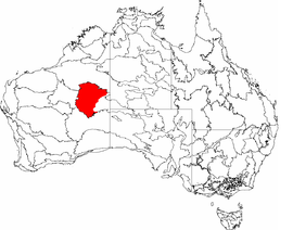
The Gibson Desert ( English: Gibson Desert ) is an Australian desert in the state of Western Australia . Its size is 156,300 km² . It is very remote and very sparsely populated.
Discovery story
Its name received the Gibson Desert of British explorer Ernest Giles in memory of Alfred Gibson , who during an expedition, the 1873 - 1874 was trying to cross the desert, lost. The two of Giles and Gibson had ridden ahead to explore the grounds. Gibson's horse died and Giles sent him back to the camp with his own horse for help. When Giles got there on foot eight days later and almost completely exhausted, Gibson had not arrived. Despite several days of searching, he was no longer found.
landscape
The landscape is characterized by sand plains, dune fields, low rock ridges and lateritic highlands. Small salt lakes lie in the center of the desert and in the southwest, including Lake Baker . There are two sedimentary basins in the Gibson Desert , the Officer and Canning Basin . These are part of the Great Artesian Basin .
climate
The desert climate is characterized by very hot summers, during which the average temperature in January can be 36 ° C. In winter, the lowest average temperature reaches 6 ° C, whereas the daytime temperature is 21 ° C. The annual rainfall is 150 mm to 200 mm. Most of the rain falls during around 20 to 30 thunderstorms each year.
fauna and Flora
Mulga bushes and grassland Spinifex grass ( Triodia basedowii ) grow on the lateritic highlands . The red dune fields and the sand plains are overgrown by bushes such as acacias , hakea and greville , which rise above the spinifex grassland ( Triodia pungens ). On the highlands in the north there are steppes of bushes and mulga bushes in the south. In the areas that were shaped by alluvial lands from the Paleocene and Quaternary , forests rise above the grasslands made up of various Coolibah tree species (species of the eucalyptus ).
In addition to the red giant kangaroo , emus also live in the Gibson Desert. Cats and foxes threaten the original wildlife. Rabbits and the numerous free-roaming camels endanger the desert plants in their existence.
Infrastructure, population, artists
The desert area, which is poor in people, is essentially accessed by two roads that are unpaved and not passable in the rainy season. In an east-west direction, the Gary Highway leads from Alice Springs to Papunya and on to the Canning Stock Route . The Canning Stock Route crosses the Gibson Desert in Wiluna in a northeasterly direction.
In the 1950s, an Aboriginal mission station was established in Wiluna with the help of the government through the church, as a nuclear test site was established in Maralinga by the British and the local Aborigines were expelled from this area. How deserted this desert area is became known worldwide in October 1984 when the last nomadic Aboriginal clan, the Pintupi Nine from the Gibson Desert, first came into contact with the white population.
The Aborigines of the Pintupi and Luritja live in the desert area . The largest population is in Warburton at the eastern end of the Gibson Desert. Another big place is Wiluna, but there are also other smaller Aboriginal settlements. There is gold and silver mining in the Warburton area and there is gold and uranium at Wiluna, the latter not currently being mined.
The Gibson Desert is part of the Western Desert cultural area . Well-known Aboriginal artists live in the Gibson Desert and are assigned to the art style of dot painting .
Individual evidence
- ↑ a b c d e f anra.gov.au ( memento of October 7, 2012 in the Internet Archive ): Gibson Desert, in English, accessed on February 26, 2013


