Glockenkogel
| Glockenkogel | ||
|---|---|---|
|
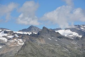
The Glockenkogel (center) in front of the Prägratkees from the southeast. The garnet point behind to the left . |
||
| height | 2828 m above sea level A. | |
| location | East Tyrol , Austria | |
| Mountains | Garnet group | |
| Dominance | 1 km → Sillingkopf | |
| Notch height | 108 m ↓ Glockenkogelscharte | |
| Coordinates | 47 ° 6 '55 " N , 12 ° 32' 40" E | |
|
|
||
| First ascent | 1923 by R. Majewski and companions | |
| Normal way | South ridge ( UIAA II ) | |
The Glockenkogel (also Glockenkogl or Klockenkogel ) is 2828 m above sea level. A. high mountain peaks in the main Alpine ridge of the Granatspitz group in the north of East Tyrol . In addition to the main summit, there is also the 2679 m above sea level. A. high west peaks.
location
The Glockenkogel is a peak in the northern central area of the Granatspitz group. It is located on the Tauern main ridge around 1.5 kilometers south of the state border with Salzburg in the municipality of Matrei in East Tyrol . It lies between the Hauptmerkogel ( 2625 m above sea level ) in the west, the Wild Mander ( 2668 m above sea level ) in the south and the Sillingkopf ( 2858 m above sea level ) in the northeast. On the east ridge of the Glockenkogel, the Hauptmerscharte ( 2542 m above sea level ) separates the Glockenkogel from the Hauptmerkopf , on the south ridge is the Wilde Manderscharte ( 2615 m above sea level ), on the northeast ridge the Blaue Hütle ( 2740 m above sea level ) and the Glockenkogelscharte ( 2720 m above sea level ). To the west and south of the summit, the St. Pöltner Ostweg runs past the summit, to the north are the Daberkees and Dabersee .
Promotion opportunities
For the ascent to the Glockenkogel, the ascent from the Matreier Tauernhaus or the St. Pöltner Hütte over the St. Pöltner Ostweg to the Wilden Mander Scharte is ideal, from where you can cross the south ridge of the Glockenkogel over a wide ridge and a narrow, exposed part achieved ( UIAA II ). The north-east ridge, which was used by the first climbers in 1923 and which can be climbed from the Glockenkogelscharte via the Blaue Hütle ( UIAA II ), presents a comparable difficulty . The north face, on the other hand, can be reached via the Daberkees, where you have to climb a steep gully between the main and western peaks ( UIAA III ). The most demanding variant is the southwest face ( UIAA IV- ).
Individual evidence
- ↑ Granatspitzgruppe Alpine Club map
- ↑ Alpine Club Guide Glockner and Granatspitz Group
- ↑ Federal Office for Metrology and Surveying Austria: Austrian Map online (Austrian map 1: 50,000)
literature
- Willi End : Alpine Club Leader Glockner and Granatspitz Group. Bergverlag Rother . 11th edition 2011, ISBN 978-3-7633-1266-5 .
- Garnet group . Alpine Club map sheet 39, 1: 25,000. Austrian Alpine Club, Innsbruck 2013, ISBN 978-3-928777-75-9 .

