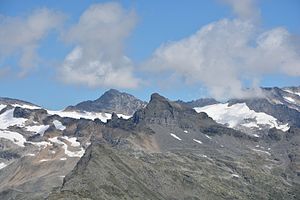
Main merchant head
| Main merchant head | ||
|---|---|---|
|
The main mercer head (left of the center of the picture in the foreground), behind it the silling head , garnet tip and Glockenkogel |
||
| height | 2625 m above sea level A. | |
| location | East Tyrol , Austria | |
| Mountains | Garnet group | |
| Dominance | 0.7 km → Glockenkogel | |
| Notch height | 108 m ↓ Hauptmerscharte | |
| Coordinates | 47 ° 6 '56 " N , 12 ° 31' 50" E | |
|
|
||
| First ascent | unknown | |
| Normal way | from Dabersee over the southwest ridge | |
The Hauptmerkopf ( 2625 m above sea level ), also Hauptmerkogl or Trogkopf , is a mountain peak in the Granatspitz Group in the north of East Tyrol (municipality of Matrei in East Tyrol ). The name of the main meralm was based on the main meralm, which owes its name to a person or owner's name. While the first ascent is unknown, Wilhelm Brandenstein , Henriette Hurych and F. Waldmann made the first crossing on July 19, 1926.
Location and promotion opportunities
The Hauptmerkopf is a peak in the northern central area of the Granatspitzgruppe. It is located around two kilometers south of the Tauern main ridge south of the state border with Salzburg . From the neighboring Glockenkogel ( 2828 m above sea level ) its west ridge runs west over the Hauptmerscharte ( 2524 m above sea level ) to the Hauptmerkopf and on to the Frögegg ( 2374 m above sea level ), from where it drops into the Tauern Valley . North of the Haupmerkopf lies the Dabersee and the Daberbach , on the south-west slope the Hauptmeralm and the Frögealm.
The ascent to the Hauptmerkopf is only possible without a path, whereby the ascent can be done via the east or west ridge. The technically simplest variant is the west ridge, whereby the ascent here is from St. Pöltner Ostweg to Dabersee and then following the lake drainage to under the west ridge and up a steep scree slope ( UIAA I ). The ascent over the east ridge begins in the Hauptmerscharte ( UIAA II ) and leads over Schrofen and a slab into the ridge.
Individual evidence
- ↑ ÖK50 , according to TIRIS 2621
- ↑ Granatspitzgruppe Alpine Club map
- ↑ Alpine Club Guide Glockner and Granatspitz Group
- ^ Wilhelm Brandenstein, Fritz Lochner-Hüttenbach: Small name-based works. Academic printing and Publishing house, Graz 1978.
literature
- Willi End : Alpine Club Leader Glockner and Granatspitz Group. Bergverlag Rother , 11th edition 2011, ISBN 978-3-7633-1266-5 .
- Garnet group . Alpine Club map sheet 39, 1: 25,000. Austrian Alpine Club, Innsbruck 2013, ISBN 978-3-928777-75-9 .

