
Tauern Valley
| Tauern Valley | ||
|---|---|---|
 View to the south into the Tauern valley |
||
| location | East Tyrol , Austria | |
| Waters | Tauernbach | |
| Mountains | Felber Tauern | |
| Geographical location | 47 ° 4 ' N , 12 ° 32' E | |
|
||
| height | 2481 to 975 m | |
| length | approx. 18 km | |
| particularities | Prosseggklamm | |

The Tauern valley is a northern side valley of the Isel valley in East Tyrol . The Tauernbach flows through it.
geography

The Tauern Valley begins at the Felber Tauern (2,481 m) and runs in a southerly direction through the municipality of Matrei (975 m) to the confluence of the Tauernbach in the Isel near Matrei. The most important secondary valleys are the Gschlößtal , the Frosnitztal and the Landeggtal .
Starting from the Felber Tauern, the hamlet Tauer with the Matreier Tauernhaus as well as the villages, hamlets or farmsteads Raneburg , Berg , Gruben and Lublaß are located in the Tauern Valley . At Stein , below the Steiner waterfalls , the Tauernbach flows through the Prosseggklamm to Prossegg . The back floodplains that followed were once overgrown with alders and willows and served as a floodplain until the stream was regulated and the floodplains were used as grassland. At the shock , the Tauernbach finally flows into the Isel after the Bretterwandbach flows into it.
history
The mule trail through the valley over the non-navigable Felber Tauern (Felben Mittersill is) already played in Roman times an important role as a link in the Felbertal . The Matreier Tauerntal also had a Tauernhaus , a medieval hospital (rest area, inn and hospice).
At the beginning of the 20th century, the Matrei-Iseltal section of the German and Austrian Alpine Association began building the Tauerntal hiking trail, which opened up the valley for tourism. The construction work took a total of twelve years. The hiking trail became known in particular through the Prosseggklamm, which has not been accessible for a number of years due to poor safety measures. In 1920 part of the Steinerbach was made usable for electricity generation. After a few expansion stages, the power plant was expanded and the Tauernbach partially diverted.
Today the valley is connected to Salzburg by the Felbertauernstrasse and the Felbertauerntunnel . The street goes back to the Tauerntalstraße, which was built between 1930 and 1937 to Lublaß. From 1964 to 1967 the Felbertauernstraße was built again, whereby the road had to be blasted into the mountain or led over bridges. In addition, the Transalpine Ölleitung (TAL) Trieste - Ingolstadt and a 380 kV power line run through the valley today . A current threat to the valley is the planned Matrei-Raneburg pumped storage power plant , for which a huge reservoir near Raneburg and a large compensation basin are planned.

Matreier Tauernhaus at the end of the Tauern Valley
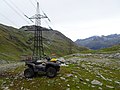
380 kV power line


literature
- Forcher, Michael (editor): Matrei in Osttirol. A parish book for the 700th anniversary of the first mention as Markt 1280-1980. Matrei 1996
- Catholic Tyrolean Teachers' Association (Ed.): District Studies East Tyrol. Innsbruck 2001

Cadastral communities: Matrei in Osttirol Land | Matrei in Osttirol market
Localities (factions): Mountain | Bichl | Field | Whole | Shine | Pits | Hinterburg | Hinteregg | Huben | Cold House | Kienburg | Klaunz | Klausen | Matrei in East Tyrol | Mattersberg | Moss | Proßegg | Raneburg | Seblas | Tauer | Waier | Zedlach
Market place:
Matrei in Osttirol |
Villages:
Bichl •
Feld •
Ganz •
Huben •
Proßegg •
Zedlach |
Hamlet:
Auer •
Berg •
Brenner •
Falter •
Hinteregg •
Kienburg •
Klaunz •
Lublaß •
Presslab •
St. Nikolaus •
Stein •
Tratten •
Wolsegger |
Rotten:
Bruggen •
Gruben •
Guggenberg •
Hinterburg •
Kaltenhaus •
Landschütz •
Moos •
Oberhuben •
Schweinach •
Seblas •
Trin •
Waier |
Settlements:
Auerfeld |
Scattered houses:
Ausser-Klaunzer-Berg •
Felbertauern •
Glanz •
Inner-Klaunzer-Berg •
Klausen •
Lottersberg •
Mattersberg •
Raneburg
Other locations:
Alte Prager Hütte •
Badener Hütte •
Felsenkapelle •
Gruben pumping station •
Grünseehütte •
Kals-Matreier-Törl refuge •
Karl-Prince hut •
pumping station Kienburg •
quarry Kienburg •
Matreier Tauernhaus •
New Prague hut •
St. Pölten hut •
Sudeten German hut •
Venedigerhaus •
Schloss Weissenstein |
Alpine pastures:
Aussergschlöß •
Innergschlöß •
Tauer
Counting district: Matrei in Osttirol | Matrei in Osttirol-Umg. | Huben and surroundings | Tauern Valley