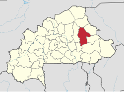
Gnagna
| Basic data | |
|---|---|
| Region : | Est |
| Capital : | Bogandé |
| Departments : | 7th |
| High Commissioner : | |
| Area : | 8470 km² |
| Residents : | 499,511 (2013 estimate) |
| ISO 3166-2 : | BF-GNA |
| location | |

|
|
Gnagna is a province in the Est region in the West African state of Burkina Faso with 499,511 inhabitants on 8470 km².
The province lies in the east and is rather sparsely populated. There are no asphalt roads, but there are airfields in Bogandé . The province is the center of Burkinabe peanut cultivation, and there are also irrigation cultures near the smaller reservoirs, for example near Manni.
Location of the departments / municipalities
| map | No. | Department / municipality |
|---|---|---|
| 1 | Bilanga | |
| 2 | Bogandé | |
| 3 | Coalla | |
| 4th | Liptougou | |
| 5 | Mani | |
| 6th | Piéla | |
| 7th | Thion |
Web links
- Gnagna Province (French)
Individual evidence
- ↑ a b c Institut national de la statistique et de la demographie [INSD] (ed.): Annuaire statistique 2013 . December 2014, Tableau 01.01: List des communes par région et par province en 2013 , Tableau 02.17: Population et densité par région et province , Tableau 02.20: Population du Burkina Faso par province de 2001 à 2013 en milieu d'année , p. 5–6, 22–23, 32–35 (French, insd.bf [PDF; 3.2 MB ; accessed on February 27, 2015]).