Goedereede
 flag |
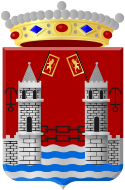
 coat of arms |
| province |
|
| local community |
|
|
Area - land - water |
16.85 km 2 16.64 km 2 0.21 km 2 |
| Residents | 2,165 (Jan. 1, 2017) |
| Coordinates | 51 ° 49 ′ N , 3 ° 59 ′ E |
| Important traffic route |
|
| prefix | 0187 |
| Postcodes | 3252 |
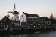
Goedereede ( ) ( Zeeland Goeree ) is a place and a former municipality in the Netherlands , province of South Holland . It has been part of the Goeree-Overflakkee community since January 1, 2013 . The total area of the place is 16.85 km² and is inhabited by 2,165 people (as of January 1, 2017).
places
The parish included the following places:
- the small town of Goedereede (about 2000 inhabitants), where the municipal administration is located
- the fishing village of Stellendam (about 3500 inhabitants)
- the tourist and fishing village of Ouddorp (about 6000 inhabitants)
- the hamlet of Havenhoofd (about 400 inhabitants)
- the hamlet of Oostdijk
Location and economy
The former municipality is located in the northwest of the island of Goeree-Overflakkee. The Haringvliet dam connects them to the mainland. A road, partly built as a motorway, leads over this dam to Vlaardingen and Rotterdam .
Ouddorp is important as a tourist destination. Ouddorp and Stellendam are also fishing villages (new fishing port on the Haringvliet dam). Horticulture is also carried out (production of flower seeds).
history
The area of today's municipality was already settled by the Romans in the 3rd century . The village of Ouddorp was probably built around 900 on what was then the island of Westvoorne. Goedereede (= good roadstead ) became an important port and fishing town in the 13th century. It received city rights in 1312 and market rights in 1331 . But Goedereede was often hit by disasters. An army band ravaged it in 1418; a city fire in 1482; There were flood disasters in 1421 (St. Elisabeth flood), 1530, 1570, 1618 and finally on February 1, 1953. The decay was accelerated by the silting up of the harbor from around 1500 onwards. Ouddorp had an important fishing port from 1860 to 1973. Stellendam was founded around 1800 as a newly founded fishing village.
Sights / tourism
- Water sports in and around the Grevelingen arm of the lake , which is separated from the North Sea by the Brouwersdam ; Campsites; Marina on the south coast
- Quiet North Sea beach on the north side (nature reserve "De Kwade Hoek").
- Nature reserve "Westduinen" where there orchids are
- the Ouddorp lighthouse (built in 1948)
- medieval church towers of the village church Sint Maarten in Ouddorp (1348) and the Catharinakerk Goedereede (built in 1512)
- Gabled houses on the market square of Goedereede
- Hikes and bike tours, etc. a. along the old mansions and large farms from the 17th century.
- Museum train RTM Ouddorp
politics
Distribution of seats in the municipal council
| Political party | Seats | |||
|---|---|---|---|---|
| 1998 | 2002 | 2006 | 2010 | |
| SGP | 5 | 5 | 5 | 5 |
| Verenigd Gemeente concern | 2 | 2 | 1 | 3 |
| CDA | 3 | 2 | 3 | 2 |
| PvdA | 2 | 2 | 2 | 2 |
| VVD | 2 | 2 | 2 | 2 |
| ChristenUnie | - | 2 | 2 | 1 |
| Vereniging Mastenbroek | - | - | 0 | - |
| RPF | 1 | - | - | - |
| total | 15th | 15th | 15th | 15th |
Web links
- Goedereede: Website of the tourist association VVV Zeeland (German, Dutch, English)
Individual evidence
- ↑ a b Kerncijfers wijken en buurten 2017 Centraal Bureau voor de Statistiek , accessed on May 30, 2018 (Dutch)
- ↑ Allocation of seats in the municipal council: 1998–2002 2006 2010 , accessed on May 30, 2018 (Dutch)


