Great Blue Hill
| Great Blue Hill | ||
|---|---|---|
|
The Great Blue Hill |
||
| height | 183 m | |
| location | Norfolk County , Massachusetts , United States | |
| Coordinates | 42 ° 12 '43 " N , 71 ° 6' 56" W | |
|
|
||
| rock | granite | |
| particularities | Highest Point in Norfolk County | |
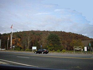
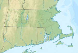
The Great Blue Hill , whose Indian name Massachusetts is, together with 193 meters (635 feet) the highest peak in Norfolk County in the state of Massachusetts of the United States and is located approximately 10 mi (16 km) southwest of Boston within the reserve Blue Hills Reservation . The mountain got its current name from the early European settlers who sailed along the coast and noticed a bluish shimmer on the protruding granite surfaces . It turned out that the blue glow is caused by riebeckite, which is contained in the rock. The eastern flank of the mountain faces the Atlantic and is already in Quincy . "Blue granite" used to be mined there.
The name of the Indian tribe of Massachusett , their language and all other word formations ( Massachusetts Bay , Massachusetts Bay Colony , etc.) is derived from the name the Indians gave the mountain: "massa-adchu-es-et". “Massa” means big , “adchu” is the hill , “it” is a diminutive suffix and means small and “et” is a locative suffix that identifies a place .
geography
The north and west sides of Great Blue Hill drains into Boston Harbor via the Neponset River , while the south and east sides first drain into the Blue Hill River , which makes its way to Boston Harbor via the Farm River , MONTIQUOT River and finally Weymouth Fore River takes place.
The top of the hill is also the highest point in Norfolk County , and is within 10 mi (16.09 km ) of the Atlantic coast south of central Maine . Therefore, the Great Blue Hill was chosen by the American meteorologist Abbott Lawrence Rotch as the location for an observatory , which after its completion in 1885 became known as the Blue Hill Meteorological Observatory . Rotch carried out fundamental studies of the earth's atmosphere there for many years and a weather station of the National Weather Service is still located there today . From the Eliot Tower at the top of the hill, you can see the city of Boston and many of the lower hills around the cities of Milton and Canton .
The hill, like the sanctuary in which it is located, is a popular destination for hikers who appreciate the well-developed trails in connection with the natural surroundings and the close proximity to the Greater Boston metropolitan area . In the Blue Hills Ski Area also can in the winter months skiing are trained - 8 descents , cross-country trails and several ski lifts are the winter sports available.
The well-known Boston TV and radio station WGBH derives its acronym from the first letters of the hill ( G reat B lue H ill), where their FM and TV broadcast antennas were located. Today the station only transmits radio signals from Great Blue Hill , while TV signals have been broadcast from a higher tower since the 1960s.
Picture gallery
Individual evidence
- ^ The Blue Hills Reservation. Massachusetts Department of Conservation and Recreation , archived from the original February 8, 2011 ; accessed on November 29, 2007 (English).
- ^ William Wallace Tooker: Algonquian Names of Some Mountains and Hills . In: Journal of American Folklore . tape 17 , no. 66 (July-September), 1904, ISSN 0021-8715 , OCLC 482597203 , p. 171–179 (English, online in Google Book Search [accessed June 1, 2012]).
- ^ The Route 128 tower complex. In: Boston Radio. Retrieved June 1, 2012 .
Web links
- Great Blue Hill in the United States Geological Survey's Geographic Names Information System
- Blue Hills Reservation website ( February 8, 2011 memento in the Internet Archive )
- Technical data for the Great Blue Hill
- Blue Hills Ski Area
- Blue Hill Observatory website
- History of the Blue Hill Observatory
- Friends of the Blue Hills website


