Grießkogel (Steinernes Meer)
| Grießkogel | ||
|---|---|---|
|
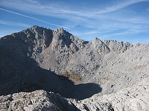
Grießkogel from the northeast, to the right of it the Ledererköpfe , in the foreground hides the Steinige Grube |
||
| height | 2543 m above sea level A. | |
| location | Border between Land Salzburg , Austria and Bavaria , Germany | |
| Mountains | Berchtesgaden Alps ( Steinernes Meer ) | |
| Dominance | 1.1 km → Funtenseetauern | |
| Notch height | 107 m ↓ Scharte to the Funtenseetauern | |
| Coordinates | 47 ° 28 '29 " N , 12 ° 58' 23" E | |
|
|
||
The Grießkogel or Grieskogel (incorrectly also Niederbrunnsulzenkopf ) is 2543 m above sea level. A. high mountain in the Stone Sea on the border between the state of Salzburg and Bavaria .
It lies between Wildalmrotkopf and Totem Weib south of the Funtenseetauern , with which it is connected by the Ledererköpfe . To the southeast is the Grießbachrotenkopf , which is only one meter lower . The Niederbrunnsulzen saddle is located around 400 meters south of the Grießkogel , the Ledererkar to the northwest and the Steinige Grube to the northeast .
The Große Reibn leads past the Grießkogel (via Lange Gasse and Niederbrunnsulzen ), as does the southern variant of the transition from the Wasseralm to the Kärlingerhaus am Funtensee . The summit can only be reached without a path, there are no marked trails.
literature
- Bernhard Kühnhauser: Alpine Club Guide Berchtesgaden Alps with Hochkönig . 20th edition. Bergverlag Rother , Munich 2011, ISBN 978-3-7633-1127-9 , pp. 566 .
Web links
Individual evidence
- ↑ Niederbrunnsulzenkopf in the Bavarikon local database; Niederbrunnsulzenkopf in the Kompass hiking map . In fact, the Niederbrunnsulzenkopf is like the Hochbrunnsulzenkopf on the Brunnsulzengrat between Niederbrunnsulzen and Hochbrunnsulzen , cf. about OpenStreetMap and list of all the peaks of the Stony Sea ( Memento of 7 September 2015 Internet Archive )

