Grouville
| Grouville | ||
|---|---|---|
|
|
||
| Coordinates | 49 ° 11 '20 " N , 2 ° 2' 44" W | |

|
||
| Symbols | ||
|
||
| Basic data | ||
| Country | jersey | |
| ISO 3166-2 | JE | |
| surface | 7.8 km² | |
| Residents | 3763 (2011) | |
| density | 482.4 Ew. / km² | |
| Website | www.parish.gov.je/grouville/ (English) | |
|
Looking south over Royal Bay from Grouville
|
||
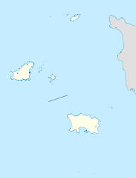
Grouville is one of the twelve parishes of Jersey . The municipality is located in the east and extreme southeast of the island and covers 4567 vergées (7.8 km², 7% of the land area of Jersey). Historically, the community was called Saint Martin de Grouville , the name was later followed by Saint Martin (historically Saint Martin le Vieux ). The community is increasingly in demand as a place to live.
Neighboring communities are Saint Martin in the north, Saint Savior in the west and Saint Clement in the south. To the east it is limited by the wide beach of Royal Bay.
Attractions
The community of Grouville shares with the neighboring community of Saint Martin, a dedication to St. Martin of Tours (St. Martin). To distinguish, the Parish church ( Parish church ) was consecrated as Saint Martin de Grouville , while that of the neighboring parish is called Saint Martin le Vieux .
The church of St. Peter La Rocque was built in the 19th century.
The Royal Bay ( Royal Bay ) of Grouville was given its royal nickname in 1846 by Queen Victoria , who was greatly impressed by the visit to the bay. The bay is valued by locals and tourists because of its wide sandy beach. This is also where the largest oyster farming area on Jersey is located, and formerly the area used for the production of algae fertilizer . Only the northernmost part of the bay with Mont Orgueil Castle and the port of Gorey does not belong to the community of Grouville, but to Saint Martin. Most of Gorey Village, Gorey Village, is part of the parish. The Royal Jersey Golf Club is also based there.
The municipal area is the most famous archaeological site jerseys, the Dolmen of La Hougue Bie , which is now a museum, which by the Jersey Heritage Trust is operated.
La Rocque was the place where the French army landed on January 6 in 1781 and the Battle of Jersey ( War of Jersey ) began.
Queen's Valley , which is now occupied by a reservoir , was the cause of heated debates in the 1980s about safeguarding Jersey's drinking water supply . A preservation of the valley could not be enforced by environmental and nature conservationists.
In 2012 the largest coin find so far, the hoard of Grouville with around 750 kg of coins from the Celtic coin, which is exhibited in the museum of La Hougue Bie , was made in the municipality .
Population development
Historical populations:
- 1991: 4,297
- 1996: 4,658
- 2001: 4,702
- 2011: 4,866
politics
The municipality is divided into four parts ( vingtaines ):
- La Vingtaine des Marais
- La Vingtaine de la Rue
- La Vingtaine de Longueville
- La Vingtaine de la Rocque
The Minquiers archipelago belongs administratively to the municipality of Grouville.
Grouville forms an electoral district and elects an MP.
All parishes in Jersey, including Grouville, have an honorary police force made up of volunteer members who have certain rights organized in a police-like manner.
education
With the Grouville School, Grouville has a primary school to which a nursery is attached. There are no secondary schools in town.
Personalities
- Harry Vardon (1870-1937), professional golfer
Partner municipality
The only partner church is currently (2017):
![]() Portbail ( Manche department ), France
Portbail ( Manche department ), France
Individual evidence
- ↑ Size and land cover of Jersey , Area of Jersey by Parish (2017), on gov.je . Retrieved September 9, 2017.
- ↑ Census 2011 , accessed on August 31, 2017.
- ^ List of Elementary Schools in Jersey , accessed September 1, 2017.


