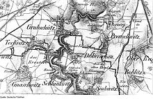
Grubschütz
|
Grubschütz
Hrubjelčicy Municipality of Doberschau-Gaussig
Coordinates: 51 ° 9 ′ 39 ″ N , 14 ° 23 ′ 14 ″ E
|
|
|---|---|
| Height : | 200 m above sea level NN |
| Residents : | 261 (May 9, 2011) |
| Incorporation : | July 1, 1950 |
| Incorporated into: | Doberschau |
| Postal code : | 02692 |
| Area code : | 03591 |
|
The Grubschützer Spreebrücke with the village in the background
|
|
Grubschütz , Upper Sorbian , is a village in the Saxon district of Bautzen . It is part of Upper Lusatia and has been part of the Doberschau-Gaußig community since 1999 . The place is part of the official Sorbian settlement area in Saxony.
geography
Grubschütz is about four kilometers southwest of Bautzen between 200 and 215 meters above sea level. NN. The area is hilly; the location falls in the southeast into the valley of the Spree . The river has washed out a narrow valley above and below the village. To the left and right of the Spree, granite walls rise in parts, which are used for climbing. The local recreation area Humboldthain is located between Grubschütz and Bautzen , a popular excursion destination for Bautzen residents.
The place consists of two core settlement parts. The older Rundweiler in the south lies on a hill above the Spree; the younger part in the north on the road towards Bautzen. The neighboring towns are Stiebitz in the north, Preuschwitz in the east, Doberschau in the south and Techritz in the southwest.
history
The place is first mentioned in 1419 as Gropschitz . Using the intermediate form Rubelschitz (16th / 17th century), which is closer to the Sorbian name, the place name developed into its current form by 1768.
In the Battle of Bautzen in May 1813, the Spreeaue near Grubschütz was used by the southern wing of the French troops under Marshal Oudinot to cross the river, as it is easy to control due to its location between the steep valleys in the north and south.
Until June 30, 1950 Grubschütz was an independent rural community. Then it was incorporated into Doberschau , with which it came to the municipality of Gnaschwitz-Doberschau in 1994 and to Doberschau-Gaussig in 1999.
population
The last population data for the municipality of Grubschütz indicate 407 inhabitants for 1946. In 1890 the place had only 177 inhabitants.
For his statistics on the Sorbian population in Upper Lusatia, Arnošt Muka determined a population of 150 inhabitants in the 1880s; 124 of them were Sorbs (83%) and 26 Germans. The use of the Sorbian language in Grubschütz has since declined sharply.
religion
The place is both Catholic and Protestant to Bautzen. The last information on religious affiliation comes from 1925. At that time, 224 of the 281 inhabitants were Evangelical Lutheran (80%) and 57 were Catholic (20%).
Infrastructure
Grubschütz is located a little south of the state road 119 (Bautzen- Neukirch ). The next junction of Autobahn 4 ( Salzenforst ) is about six kilometers away in a north-westerly direction and can be reached via the S 106 motorway slip road, which branches off the S 119 west of Grubschütz. Regional bus routes connect the place with the city of Bautzen.
Personalities
- Martha Fuchs (1892–1966), SPD politician, born in Grubschütz
literature
- Grubschütz in the Digital Historical Directory of Saxony
Individual evidence
- ↑ Small-scale municipality sheet for Doberschau-Gaussig. (PDF; 0.23 MB) State Statistical Office of the Free State of Saxony , September 2014, accessed on February 2, 2015 .
- ↑ Ernst Tschernik: The development of the Sorbian population . Akademie-Verlag, Berlin.

