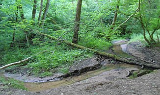
Grumbach (Rohrbach)
| Grumbach | ||
|
The Grumbach in Schafbrücke |
||
| Data | ||
| Water code | DE : 264346 | |
| location |
Palatinate-Saarland Muschelkalkgebiet
|
|
| River system | Rhine | |
| Drain over | Rohrbach → Saar → Moselle → Rhine → North Sea | |
| source | in the Sankt Ingbert-Kirkeler forest area on the Steinkopf , near Ensheim and Sengscheid 49 ° 15 ′ 0 ″ N , 7 ° 6 ′ 20 ″ E |
|
| Source height | approx. 350 m above sea level NHN | |
| muzzle | in Saarbrücken in the Rohrbach Coordinates: 49 ° 13 '37 " N , 7 ° 2' 53" E 49 ° 13 '37 " N , 7 ° 2' 53" E |
|
| Mouth height | approx. 200 m above sea level NHN | |
| Height difference | approx. 150 m | |
| Bottom slope | approx. 26 ‰ | |
| length | 5.7 km | |
| Catchment area | 6.71 km² | |
The Grumbach is an easterly and orographically left tributary of the Rohrbach in Saarland, almost six kilometers long . It flows in particular in the area of the state capital Saarbrücken ; a short section runs through the Saar- Palatinate district .
geography
course
The Grumbach rises in the Sankt Ingbert-Kirkeler forest area . Its source lies in the north of the Saarbrücken district of Ensheim , about 700 m southeast of the St. Ingbert district of Sengscheid on the southern flank of the Steinkopf mountain .
The Grumbach, which flows exclusively in the urban areas of Saarbrücken and St. Ingbert, runs after leaving the Steinkopf through the Grumbach Valley, which is wooded in sections and otherwise lined with forests below the federal motorway 6 . He crosses under the A 6 under the Grumbachtal bridge ; there it runs for a few hundred meters through the Saar-Palatinate district. The stream then flows in the Schafbrücke district of Saarbrücken on the right-hand side at a small distance along the Grumbachtalweg - to its end.
Almost 150 m after crossing under Kaiserstraße and the embankment of the Mannheim – Saarbrücken railway line , the Grumbach flows into the Saar tributary Rohrbach, which comes from the north-northeast, in the Schafbrücke district of Saarbrücken .
In the Grumbach valley the brook flows through at least four small ponds.
Catchment area
The 6.71 km² catchment area of the Grumbach lies in the Saarbrücken-Kirkeler Forest and is drained to the North Sea via the Rohrbach, the Saar, the Moselle and the Rhine .
It borders
- in the east to that of the Wieschbach , which drains over the Saarbach into the Saar
- in the south to that of the Saarbach itself
- and in the west and north to that of the Rohrbach.
The highest point is 399.6 m above sea level. NHN high stone head in the north of the catchment area.
Most of the catchment area is forested, in the north beech forests dominate.
The Grumbachtal is under landscape protection .
Tributaries
Numerous streams and rivulets flow into the Grumbach; the longest tributary is the Stiefelbach, which is about half a kilometer long.
Inflows from the source to the mouth:
- Stiefelbach ( right ), 0.5 km
- Kallenbrunnen ( left ), 0.1 km
- Steigelborn ( left ), 0.2 km
- Dörrwiesgraben ( right ), 0.4 km, 0.66 km²
- Haseneckbach ( left ), 0.3 km
- Hansenbrüchelchen ( right ), 0.2 km
- Boksbergbach ( left ), 0.3 km
- Pillerwiesbach ( right ), 0.1 km
- Kutzenrottbach ( right ), 0.1 km
- Scheidterbergbach ( right ), 0.2 km
- Kleingartenbach ( right ), 0.1 km
- Wacholderbach ( right ), 0.3 km
Individual evidence
- ↑ a b Self-measurement on the Saarland geoportal
- ↑ Geoportal Saarland map viewer for the Saarland ( information )
- ↑ Map services of the Federal Agency for Nature Conservation ( information )
