
Palatinate-Saarland Muschelkalkgebiet
| Palatinate-Saarland Muschelkalkgebiet | |||
|---|---|---|---|
| surface | 1 123 km² (only D) | ||
| Systematics according to | Handbook of the natural spatial structure of Germany | ||
| Greater region 1st order | 07–23 → Layer level land on both sides of the Upper Rhine Rift |
||
| Greater region 2nd order | 17–19, 26 → Palatinate-Saarland layer level country |
||
| Greater region 3rd order | 18, 26 → Palatinate-Saarland Muschelkalkgebiet and Gutland |
||
| Main unit group | 18 → Palatinate-Saarland Muschelkalkgebiet |
||
| Natural area characteristics | |||
| Landscape type | Layered landscape (shell limestone) | ||
| Geographical location | |||
| Coordinates | 49 ° 8 '34.8 " N , 7 ° 21' 46.8" E | ||
|
|||
| state | Rhineland-Palatinate , Saarland | ||
| Country | Germany , France | ||

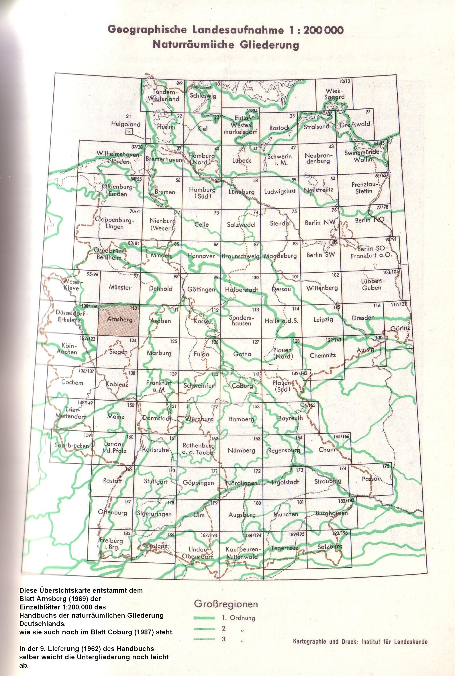
The Palatinate-Saarland Muschelkalkgebiet , or Palatinate-Saarland-Lorraine Muschelkalkgebiet would be more correct , is a third-order natural spatial region in the south-west of Rhineland-Palatinate , in the southern Saarland and, on the French side, in the north of Lorraine and in Crooked Alsace . The name comes from the handbook of the natural spatial structure of Germany , where the area bears the code number 18.
Within the north of France layer level country , it represents the layer level (s) of the shell limestone , but also changes locally into the red sandstone. Its core area is divided into the Zweibrücker Westrich (Upper Buntsandstein with attached Lower Muschelkalk) in the east and the Saar-Blies-Gau with the Bliesgau (Upper Muschelkalk) in the southeast.
To the north-west of it lies the Merziger Muschelkalkplatte together with (Lower) Saargau , which is separated from the heartland by the Lorraine Keuperniederung ( Keuper ), the Warndt ( red sandstone to carbon ) and the Saar coal forest (carbon). The Institut für Landeskunde has counted this as part of the greater region of the Gutland (main unit group 26) since 1969 , but is numerically sorted into group 18 in Blatt Saarbrücken (1972) from the same company as well as in the Saarland internal classification according to Tassels (1992).
Natural structure
The sheet Saarbrücken (Helga Schneider 1972), which covers large parts of the local landscape, in particular the Saar-Blies-Gau, is by far the most extensive single sheet 1: 200,000 of the Institute for Regional Studies and also differs considerably from the neighboring sheets in terms of scale from.
In particular, the Saar-Nied-Gau (183) and Nied-Rossel-Gau (184) landscapes, which are declared main units, do not meet the typical requirements for main units. Rather, the Saar-Nied-Gau represents the part of the Merziger Muschelkalkplatte located to the left of the Saar and the Nied-Rossel Gau encompasses the Keuper landscape of the Lorraine Keuper lowlands with red sandstone ( Spicherer heights ) and shell limestone landscapes ( Kadenbronner Gau ), which are only separated from their core landscapes by the Saar.
So that the overview is not lost, the landscapes listed below are structured according to their actual layer level, while the key figures are taken from the Saarbrücken sheet.
The Saarbrücken-Kirkeler forest area, which was first defined as the main unit in the Saarbrücken sheet and actually located in the red sandstone, is listed here as the main unit of the Muschelkalk area. In the handbook of the natural spatial structure of Germany it was combined with the geologically quite different landscapes of Kirkeler Schwelle , St. Ingberter Senke , Saarkohlenwald and Warndt to form the main unit of the Central Saarland Forest . Meanwhile, the combination of the Ingberter Senke (together with Kirkeler threshold) with the Kaiserslauterer Senke to the St. Ingbert-Kaiserslauterer Senke ( Westricher Niederung ) from sheet Saarbrücken has largely prevailed, so that z. B. was also taken over into the Saarland internal classification according to Quasten (1992). Quasten also agrees with Schneider to lead the Saarkohlenwald and Warndt as the main units of the neighboring Saar-Nahe-Bergland group to the north to northeast .
The spatially separated Merziger Muschelkalkplatte is included in the following list, but shown in lower case:
- 18 Palatinate-Saarland Muschelkalkgebiet
- 180 Zweibrücker Westrich
- 180.0 Sickinger level
- 180.1 Eastern western border
- 180.10 Moosalbtal area
- 180.11 Eppenbrunn hill country
- 180.2 Sickinger height
- 180.3 Zweibrücken hill country
- 180.30 Lower Schwarzbachtal widening
- 180.32 Swallow Hills
- 181 (/ 4) Saar-Blies-Gau
- 181.0 Vorderer Bliesgau
- 181.00 Saarbach-Woogbach-Grounds (Bischmisheimer Riedel)
- 181.01 Ommersheim limestone slab
- 181.1 Bliesgau plateaus
- 181.10 Saar-Blies plateau
- 181.11 Kahlenberg plateau
- 181.2 Hinterer Bliesgau
- 181.20 Middle Bickenalbtal
- 181.21 Schloßhübel
- 181.3 Lower Bliestal
- 181.30 Blieskasteler Bliestal
- 181,300 Ingweiler valley widening
- 181.301 Blieskasteler valley funnel
- 181.31 Gersheimer Bliestal
- 181.32 Bliesransbacher loops
- 181.30 Blieskasteler Bliestal
- 181.4 Saargemünder Saar Valley
- 181.40 Sarreguemines Basin
- 184.2 Kadenbronn Gau
- 181.0 Vorderer Bliesgau
- 186 (/ 4) Saarbrücken-Kirkeler Forest
- 186.0 Sankt Ingbert-Kirkeler forest area
- 186.00 Kirkeler Forest
- 186.01 Würzbachengal
- 186.02 St. Ingbert Forest
- 186.1 St. Johanner Wald and Scheidter Berg
- 184.3 Spicherer Heights
- 186.0 Sankt Ingbert-Kirkeler forest area
-
182/183 Merziger Muschelkalkplatte
-
182.0 Seffersbach-Mühlenbach edge plates
- 182.00 Reisberg and Seffersbachengtal
- 182.01 Wahlener plate
- 182.02 HAUSADTER level
- 182.1 Merchinger Höhe
-
183.0 Saargau edge plates
- 183.00 Tünsdorfer Riedel
- 183.01 Orscholz Limestone Plate
-
183.1 Merziger Saargau
- 183.10 Saargau plateau
- 183.11 Waldwieser Gau
- 183.2 Niedaltdorfer Niedtal
- 183.3 Limberg
- 183.4 Ittersdorf district
-
182.0 Seffersbach-Mühlenbach edge plates
- 180 Zweibrücker Westrich
The above list is largely compatible with the Saarland-internal classification according to Quasten (1992) , which designates significantly fewer units . Meanwhile, in the latter, the Vordere Bliesgau (181.0) is assigned to the Zweibrücker Westrich (180).
Shift levels

The Zweibrücker Westrich adjoins the Lower and Middle Buntsandstein of the Palatinate Forest in a comparatively smooth transition to the west. While there is still Upper Buntsandstein in the valleys, Lower Muschelkalk rests on the higher elevations , which overall leads to a relatively flat plateau landscape with deeply cut valleys. The high elevations are partly wooded and partly used as grassland. The northern part of the Westrich, the Sickinger Höhe , falls to the north and west in a pronounced stratification , the Sickinger level , to the St. Ingbert – Kaiserslauterer Senke .
South of Homburg , the Sickinger step meets the valley of the Blies . To the west, beyond this valley, a clear land step to the sub-basins of the Homburg Basin and the St. Ingbert Basin remains recognizable, but here the edge of the plateau is somewhat wider and has a more pronounced relief in the red sandstone of the Saarbrücken-Kirkeler Forest . This comes very close to the Sickinger step on the Bliestalenge between Schwarzenacker in the east and Wörschweiler in the west. Overall, however, the red sandstone level remains comparatively narrow in the south-north direction at around 5 km with a west-south-west length of around 20 kilometers. Its western part merges to the north into the saar coal forest , which is characterized by carbonaceous rocks .
South of the forest area of red sandstone comes in from Blieskastel to the south of Saarbrücken reaching Middle Bliesgau in Lower Muschelkalk about, but which is slightly less than on the zertalt Sickinger height. Quasten explicitly counts this strip of land as part of Westrich, while the Institute for Regional Studies regards the Bliestal near Blieskastel as its western border.
To the south of Blieskastels, the Westrich flattens into a depression that follows the middle section of the Bickenalb and the Petersbach in the south, and finally the middle course of its receiving stream Eichel near Diemeringen . This depression marks the transition to the Upper Muschelkalk or the main Saar-Blies-Gau unit , which in the two main mountain ranges of the Bliesgau and other elevations adjoining it to the south reaches heights of around 400 meters similar to the west of the Zweibrücker Westrich, but a completely different one Has relief. The rise takes place comparatively evenly, the valleys of the main rivers Saar , Blies and Eichel , with some restrictions also that of the Isch , manage to cut into the shell limestone. In contrast, the smaller streams, such as the Mandelbach or Ache , are only moderately deep and less steep than those in the Westrich. Compared to Westrich, the soils are significantly more fertile and are used intensively for agriculture; they are only forested like islands.
To the left of the Saar and south of Saarbrücken, there are transitions analogous to those between Bliesgau and Saarbrücken-Kirkeler Wald from the Kadenbronner Gau (shell limestone) to the Spicherer Heights (red sandstone); in the northwest, the large landscape ends in the flattening of the Saarbrücken-Forbacher Senke . To the west and south, the Kadenbronner Gau borders directly on the flat, undulating Lorraine Keuperniederung , which penetrates significantly further east to the south. At Sarralbe , the Saar, which comes from the south, also reaches the Keuper in the meantime , but collapses again immediately to the northeast into the shell limestone, which forces it into two striking loops at Zetting .
In terms of natural space , the Muschelkalk region stretches to the south, far from the west, around the Vosges , but is not further divided into sub- natural areas according to the German system. In the area of the Pfalzburger Mulde , which adjoins Saar-Blies-Gau and Zweibrücker Westrich immediately to the south, the boundaries between Upper and Lower Muschelkalk are more blurred.
Rivers
The main rivers of the Muschelkalk region are the Upper Saar , which flows through the west of the landscape and faces north, and the Blies below Homburg , which is hydrologically equal and comes from the north , which unite in Sarreguemines , just across the German-French border.
Other main rivers are, from north to south:
- in the northeast of the Schwarzbach (to the Blies) below Waldfischbach-Burgalbens
- in particular the complete sub-system of the Hornbach
- the acorn
- the isch
Historic district landscapes
The Palatinate-Saarland Muschelkalkgebiet includes in particular the following historical districts (from north to south):
- (Lower) Saargau (on the spatially separated Merzig Muschelkalkplatte)
- Bliesgau
- Imgau in the west of Bitscher Land
- Eichelgau near Diemeringen
- Upper Saargau near Sarrebourg
Individual evidence
- ^ A b Emil Meynen , Josef Schmithüsen : Handbook of the natural spatial structure of Germany . Federal Institute for Regional Studies, Remagen / Bad Godesberg 1953–1962 (9 deliveries in 8 books, updated map 1: 1,000,000 with main units 1960).
- ↑ Division into large regions since 1969 , as it was published until the Federal Agency was dissolved in the early 1990s.
-
↑ Various authors: Geographische Landesaufnahme: The natural spatial units in single sheets 1: 200,000 . Federal Institute for Regional Studies, Bad Godesberg 1952–1994. → Online maps
- Sheet 159: Saarbrücken (Helga Schneider 1972; 154 pages)
- Sheet 160: Landau id Pfalz (Adalbert Pemöller 1969; 47 pages)
- ↑ Schneider / Werle systems vs tassels on one card (PDF, 2.0 MB)