
Gułdowy
| Gułdowy | |||
|---|---|---|---|
 Help on coat of arms |
|
||
| Basic data | |||
| State : | Poland | ||
| Voivodeship : | Silesia | ||
| Powiat : | Cieszyn | ||
| Gmina : | Cieszyn | ||
| Geographic location : | 49 ° 45 ' N , 18 ° 41' E | ||
| Residents : | 193 (1997) | ||
| Postal code : | 43-400 | ||
| Telephone code : | (+48) 33 | ||
| License plate : | SCI | ||

Gułdowy (originally Gołdów , also Gułdów , German Guldau ) is a district of Cieszyn in the powiat Cieszyński of the Silesian Voivodeship in Poland .
geography
Gułdowy is located on the Kraśnianka stream in the Silesian Foothills ( Pogórze Śląskie ) , about three kilometers southeast of the city center.
In 1910 the place had an area of 311 ha . Neighboring towns: Krasna in the north, Bobrek in the northwest, Mnisztwo in the west, Dzięgielów in the south, Bażanowice in the east.
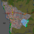
Location of Gułdowy in Cieszyn

history
The place was first mentioned in the year 1461 in the sentence z folwerky Goldowem is tiem folwarkem ktery przed Tiessinem protiw blechu zalezi, k Goldowu , and then as Guldowskymu (1572), Guldowy (1577), Guldau (1657) and so on. The name is derived from the first name of the original owner Gołda , initially with the typical word ending -ów, from the 16th century with the pluralized form -owy.
Politically, the village originally belonged to the Duchy of Teschen , the feudal lordship of the Kingdom of Bohemia , and since 1526 it has belonged to the Habsburg monarchy .
After the abolition of patrimonial it became a district of the municipality of Krasna in Austrian Silesia , Teschen district and judicial district Teschen from 1850 . In 1900 Gułdowy had 15 houses with 173 inhabitants, all of them Polish-speaking, 99 (57.2%) Roman Catholic, 72 (41.6%) Protestant, 2 (1.2%) Israelite. In 1910 there were 18 houses with 190 inhabitants, all of them Polish-speaking, 97 (51.1%) Roman Catholic, 88 (46.3%) Protestant, 5 (2.6%) Israelite.
In 1920, after the collapse of the Austro-Hungarian monarchy and the end of the Polish-Czechoslovak border war , Gułdowy became part of Poland. This was only interrupted by the occupation of Poland by the Wehrmacht in World War II .
Boguszowice was incorporated in 1973 with Krasna as a district of Cieszyns.
Personalities
- Jan Szuścik (1879–1941), Polish national and popular activist, member of the Silesian Parliament (1922–1930), Mayor of Łazy (1938–1939)
Web links
Individual evidence
- ↑ Study uwarunkowań i kierunków zagospodarowania przestrzennego miasta Cieszyna . In: www.um.cieszyn.bip-gov.info.pl . October 6, 2008. ( Page no longer available , search in web archives ) Info: The link was automatically marked as defective. Please check the link according to the instructions and then remove this notice.
- ↑ a b c Robert Mrózek: Nazwy miejscowe dawnego Śląska Cieszyńskiego . Uniwersytet Śląski w Katowicach , 1984, ISSN 0208-6336 , p. 75 (Polish).
- ↑ Marcin Żerański: Śląsk Cieszyński od Bielsko-Białej do Ostrawy. Przewodnik turystyczny . Pracownia na Pastwiskach, Cieszyn 2012, ISBN 978-83-933109-3-7 , p. 264 (Polish).
- ↑ a b Ludwig Patryn (ed): The results of the census of December 31, 1910 in Silesia , Opava 1912.
- ^ Idzi Panic: Śląsk Cieszyński w średniowieczu (do 1528) . Starostwo Powiatowe w Cieszynie, Cieszyn 2010, ISBN 978-83-926929-3-5 , p. 313 (Polish).
- ^ Community encyclopedia of the kingdoms and countries represented in the Imperial Council, edited on the basis of the results of the census of December 31, 1900, XI. Silesia . Vienna 1906 ( online ).