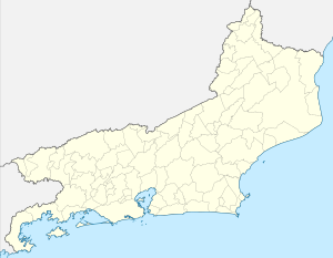
Guanabara Bay
| Guanabara Bay | ||
|---|---|---|
|
The bay from space |
||
| Waters | South Atlantic | |
| Land mass | South America | |
| Geographical location | 22 ° 47 ′ S , 43 ° 8 ′ W | |
|
|
||
| surface | 380 km² | |
| Islands | Ilha do Governador , Paquetá and others | |
|
Entrance to Guanabara Bay as seen from Morro Corcovado . On the right the open sea. Foreground: Botafogo Bay. |
||
The Guanabara Bay , Portuguese Baía de Guanabara , German also Bay of Guanabara , Guanabara Bay is a 380 km² sea bay in Brazil , on the western side of which lies the city of Rio de Janeiro and on the eastern side of Niterói . At the western sea-side entrance to the bay is the Sugar Loaf , the world-famous landmark of Rio. The name of the bay comes from the Tupi language : goanã-pará ; taken apart goa "bay", nã "similar" and pará "sea".
Surname
The Portuguese explorer Gaspar de Lemos mistakenly believed the bay to be the mouth of a large river when it was discovered in January 1502, which he therefore called the “January River” ( rio “river”, janeiro “January”). He did not know that the Tamoio Indians who lived there called the Bay Guanabara , which means "inlet".
geography
On the eastern bank of the bay, which is about 1.5 km wide at its narrowest point, lies Niterói . This city with around half a million inhabitants (as of 2015) was the capital of the state of Rio de Janeiro until 1975 . In the same year the state of Guanabara with the capital Rio de Janeiro was merged with the state of Rio de Janeiro and lost its name. Until the relocation of the capital of Brazil from Rio de Janeiro to Brasília in 1960, Guanabara was the federal district of Brazil.
The Rio-Niterói Bridge , completed in 1974 , a 14 km long and at its highest point 70 meters high motorway bridge connects Rio de Janeiro with Niterói over the entire width of the bay known as the “Bay of Guanabara”. The bridge offers a beautiful view of the Sugar Loaf and Rio de Janeiro. Both cities operate their commercial ports on the respective banks of the bay, with the port of Rio de Janeiro having been Brazil's second largest general cargo port after Santos for decades . Navy ports and numerous shipyards, including for oil rigs , are also located on the shores of the bay.
One of the islands in the bay is the Ilha Fiscal . It used to be a tax and customs post and is now a naval museum.
2016 Summer Olympics
The bay was the venue for the surfing and sailing competitions of the 2016 Summer Olympics and the 2016 Summer Paralympics . For the games, the Marina da Glória on the western side of the bay was extensively rebuilt to be used as a venue.
Restoring water quality was one of the biggest environmental promises related to bidding to host the 2016 Olympics; however, it was neglected in connection with the state financial crisis. In the months leading up to the Olympics, numerous athletes were already complaining about the pollution.
environment
Of the many small islands scattered around the bay, the romantic island of Paquetá , which is particularly popular with painters, is still a paradise with a little bit of a South Seas atmosphere. However, dolphins and bottlenose dolphins have become rare, the city administration of Rio is fighting with international support to repair serious environmental damage : for decades, untreated sewage from the metropolis has been channeled into the bay via numerous, in some cases already biologically dead, tributaries. Around three billion euros have been invested in twenty years.
The catch of the remaining five fishing colonies in the bay decreased to about 13 tons (t) daily (2004). This is offset by an oil inflow of approx. 7 t daily from 16 oil terminals, 12 shipyards and around 6,000 industrial companies with approx. 340 t of organic waste per day, of which only about a quarter is adequately treated. Almost 10 million people live in the 16 municipalities of the hydrographic catchment area. At least 35 small rivers flow into the bay.
The KPC germ was found here as early as 2014 , a pathogen that is multi-resistant to antibiotics ; According to a study published in mid-2016, “Super Bacteria” ( MRSA ) were found on five beaches off Rio : They probably get into the sea via hospital sewage.
literature
- Claude Lévi-Strauss : Sad Tropics , from the French by Eva Moldenhauer; Suhrkamp Verlag, Frankfurt, 1978; Chapter IX Guanabara , pp. 71-80, ISBN 3-518-57206-7
Individual evidence
- ↑ a b c d Carsten Upadek: Olympia 2016: Superbacteria in front of Rio's beaches. In: deutschlandfunk.de. Deutschlandfunk , June 19, 2016, accessed June 20, 2014 .
- ^ The Rio 2016 legacy: the new Marina da Glória


