
Distrito Federal do Brasil
| Distrito Federal do Brasil | |||
|---|---|---|---|
  |
|||
| Symbols | |||
|
|||
| Basic data | |||
| Country | Brazil | ||
| Capital | Brasília | ||
| surface | 5,789.2 km² | ||
| Residents | 2,570,160 (2010) | ||
| density | 444 inhabitants per km² | ||
| ISO 3166-2 | BR-DF | ||
.svg)
.svg)
Coordinates: 15 ° 47 ′ S , 47 ° 47 ′ W

.jpg)

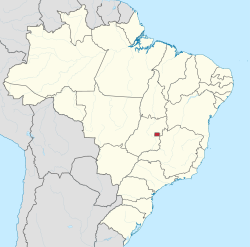
The Distrito Federal of Brazil is a capital district around the capital of Brazil. The current district is located in the central highlands on the border of the states of Goiás and Minas Gerais .
history
Município Neutro and Distrito Federal 1834–1960
Before Brasília became the capital, it had been Rio de Janeiro since 1763 , before Salvador da Bahia . As early as 1834, the city of Rio de Janeiro was separated as Município Neutro ( Neutral City ) from the province of Rio de Janeiro , creating the first capital district. With the end of the Brazilian Empire and the conversion of the provinces into states in 1889, the Município Neutro became the Distrito Federal .
With the transfer of the capital to Brasília in 1960 and the formation of the Federal District there , the previous one in Rio de Janeiro was converted into the state of Guanabara . In 1975 Guanabara became part of the state of Rio de Janeiro.
Creation of the planned capital
As early as 1823, the idea of creating an artificial planned capital based on the model of Washington was introduced in a bill . The reasons given were the insecurity of the then capital and coastal city of Rio de Janeiro against external enemies and internal unrest as well as support for the underdeveloped center of the country. However, it took until 1891 for the project to be included in the constitution.
In the decades that followed, plans were made, sometimes with more and sometimes less enthusiasm, and in some cases even built. It took until the 1950s for the final planning and implementation of the Federal District to be carried out under President Juscelino Kubitschek, which came into force on April 21, 1960 with the move of the President, Parliament and Supreme Court.
Administrative division
The federal district is identical to the municipality of Brasília . In addition to the administrative region of Plano Piloto (around 200,000 inhabitants), which is also sometimes referred to as Brasília and with 472.12 square kilometers, about eight percent of the total area, the federal district consists of 30 further administrative regions ( Regiões Administrativas ) with a total of around 2.5 Million inhabitants:
- RA I Plano Piloto (until 1997 Brasilia )
- RA II Gama
- RA III Taguatinga
- RA IV Brazlândia
- RA V Sobradinho
- RA VI Planaltina
- RA VII Paranoá
- RA VIII Núcleo Bandeirante
- RA IX Ceilândia
- RA X Guará
- RA XI Cruzeiro
- RA XII Samambaia
- RA XIII Santa Maria
- RA XIV São Sebastião
- RA XV Recanto das Emas
- RA XVI Lago Sul
- RA XVII Riacho Fundo
- RA XVIII Lago Norte
- RA XIX Candangolândia
- RA XX Águas Claras
- RA XXI Riacho Fundo II
- RA XXII Sudoeste / Octogonal
- RA XXIII Varjao
- RA XXIV Park Way
- RA XXV SCIA
- RA XXVI Sobradinho II
- RA XXVII Jardim Botânico
- RA XXVIII Itapoã
- RA XXIX SIA
- RA XXX Vicente Pires
- RA XXXI Fercal
To 1969 prior Federal District a prefect ( Prefeito ; corresponds to a mayor ) before, since the district has a governor ( Governador ) as the head, which simultaneously performs the functions of a mayor. The federal district sends three members to the Senate and eight members to the Chamber of Deputies ( Câmara dos Deputados ) of the National Congress .
The population figures in the following table refer to the census of August 1, 2000. At that time, the federal district consisted of 19 administrative regions.
| Surname | Area in km² | Percentage ownership % | population | Percentage ownership % | Inhabitants / km² |
|---|---|---|---|---|---|
| Plano Piloto | 472.12 | 8.1 | 198,422 | 9.6 | 420.0 |
| Brazlândia | 474.83 | 8.2 | 52,698 | 2.5 | 110.9 |
| Candangolândia | 6.61 | 0.1 | 15,634 | 0.7 | 2,365.2 |
| Ceilândia | 230.33 | 3.9 | 344.039 | 16.7 | 1,493.6 |
| Cruzeiro | 8.90 | 0.2 | 63,883 | 3.1 | 7,177.8 |
| Gama | 276.34 | 4.7 | 130,580 | 6.3 | 472.5 |
| Guará | 45.46 | 0.7 | 115,385 | 5.6 | 2,538.1 |
| Lago Norte | 66.08 | 1.1 | 29,505 | 1.4 | 446.5 |
| Lago Sul | 183.39 | 3.1 | 28,137 | 1.3 | 153.4 |
| Núcleo Bandeirante | 80.43 | 1.3 | 36,472 | 1.7 | 453.4 |
| Paranoá | 853.33 | 14.7 | 54.902 | 2.6 | 64.3 |
| Planaltina | 1,534.69 | 26.5 | 147.114 | 7.1 | 95.8 |
| Recanto das Emas | 101.22 | 1.7 | 93.287 | 4.5 | 921.6 |
| Riacho Fundo | 56.02 | 0.9 | 41,404 | 2.0 | 739.0 |
| Samambaia | 105.70 | 1.8 | 164.319 | 8.0 | 1,554.5 |
| Santa Maria | 215.86 | 3.7 | 98,679 | 4.8 | 457.1 |
| São Sebastião | 383.71 | 6.6 | 64,322 | 3.1 | 167.6 |
| Sobradinho | 572.59 | 9.8 | 128,789 | 6.2 | 224.9 |
| Taguatinga | 121.55 | 2.0 | 243,575 | 11.8 | 2,003.9 |
| Federal District | 5,789.16 | 100 | 2,051,146 | 100 | 354.3 |
Population development
| year | Residents |
|---|---|
| 1960 | 141,742 |
| 1970 | 546.015 |
| 1980 | 1,203,333 |
| 1991 | 1,598,415 |
| 2000 | 2,043,169 |
| 2010 | 2,570,160 |
| 2019 | 3,015,268 |
 |
|
Constitution
Similar to the Austrian capital Vienna, the federal district largely combines the competencies of the regional authorities at two levels. For example, there is only one legislature - instead of the usual state and local authority - and only one executive power, which is exercised by the governor, who also has the powers of a mayor. However, some tasks in the federal district that are otherwise the responsibility of the states are carried out by the federal government.
Web links
- Official website of the Federal District (Portuguese)
- Info Brasília - Fanpage (Portuguese, English)
Individual evidence
- ^ Federal District - Panorama. In: cidades.ibge.gov.br. IBGE , accessed May 11, 2020 .
Acre | Alagoas | Amapá | Amazon | Bahia | Ceará | ( Distrito Federal do Brasil ) | Espírito Santo | Goiás | Maranhão | Mato Grosso | Mato Grosso do Sul | Minas Gerais | Pará | Paraíba | Paraná | Pernambuco | Piauí | Rio de Janeiro | Rio Grande do Norte | Rio Grande do Sul | Rondônia | Roraima | Santa Catarina | São Paulo | Sergipe | Tocantins