
Guangfu (Hualien)
|
Guangfu 光復 鄉 |
|||
.svg) Location of Guangfu in Hualien County |
|||
| State : |
|
||
| County : | Hualien | ||
| Coordinates : | 23 ° 40 ′ N , 121 ° 25 ′ E | ||
| Area : | 157.1100 km² | ||
| Residents : | 12,846 (March 2018) | ||
| Population density : | 82 inhabitants per km² | ||
| Time zone : | UTC + 8 (Chungyuan time) | ||
| Telephone code : | (+886) (0) 3 | ||
| Postal code : | 976 | ||
| ISO 3166-2 : | TW-HUA | ||
| Community type : | Rural community ( 鄉 ) | ||
| Structure : | 14 villages ( 村 ) | ||
| Mayor : | Lin Qingshui ( 林 清水 ) ( KMT ) | ||
| Website : | |||
|
|||

Guangfu ( Chinese 光復 鄉 , Pinyin Guāngfù Xiāng ) is a rural community in Hualien County in the Republic of China, Taiwan .
Location and climate
Guangfu is located in the northern half of the Huatung Valley , which stretches along the east coast of Taiwan. The Haian Mountains in the east and the Central Mountains in the west form the natural geographical boundary of the valley and the municipality. The three main rivers in Guangfu are the Tai'an ( 太 鞍 溪 ), Hualien ( 花蓮 溪 ) and Guangfu ( 光復 溪 ). The climate is subtropical and characterized by the monsoons . The annual mean temperature is around 22.7 ° C and the annual precipitation is around 2590 mm with an average of 143 rainy days per year. The neighboring communities of Guangfu are Fenglin in the north, Fengbin in the east, Ruisui in the south and Wanrong in the west.
history
The original inhabitants of the area belonged to the indigenous ethnic groups of Taiwan (mostly Amis ). Since the middle of the 19th century, an increasing number of Han Chinese immigrated . After Taiwan became part of the Republic of China after World War II , the community was named Guangfu Xiang ( 光復 鄉 , " Reclaimed Rural Community") on March 1, 1947 to commemorate the event . With the relocation of the Chinese National Government to Taiwan in 1949, many Kuomintang followers from mainland China (many from the southern provinces of Fujian and Guangdong ) came to Taiwan and also settled in Guangfu. Often they were former military personnel. This changed the ethnic composition of the population significantly. The historical highest population level reached Guangfu in 1971 with 23,628 inhabitants. Since then the population has decreased continuously.
In 2014, representatives of the indigenous population demanded that the community name be changed to the Austronesian name Matei ( 馬太 ).
| Structure of Guangfu |
|
a: Dahua 大 華 村
b: Da'ān 大安 村
c: Dajin 大 進村
d: Datong 大同 村
e: Daping 大平 村
f: Beifu 北 富 村
a
b
c
d
e
f
Da'ma
大馬 村 Daxing
大興 村 Dafeng
大 豐村 Dongfu
東 富 村 Dafu
大 富 村 Daqua
大全 村 Xifu
西 富 村 Nanfu
南 富 村 |

administration
Guangfu is divided into 14 villages: Dahua ( 大 華 村 ), Da'ān ( 大安 村 ), Dajin ( 大 進村 ), Datong ( 大同 村 ), Daping ( 大平 村 ), Beifu ( 北 富 村 ), Da'ma ( 大馬 村 ), Daxing ( 大興 村 ), Dafeng ( 大 豐村 ), Dongfu ( 東 富 村 ), Dafu ( 大 富 村 ), Daqua ( 大全 村 ), Xifu ( 西 富 村 ) and Nanfu ( 南 富 村 ).
population
At the end of 2017, 6,822 members of indigenous peoples, or around 53 percent of the population, lived in Guangfu. The other half of the population consists mostly of Hoklo and Hakka . The latter are disproportionately strong in Guangfu compared to the Taiwanese average.
Agriculture
Most of the population is employed in agriculture. Typical products of the region are different types of rice, various fruits and vegetables, bamboo shoots , Catjang beans ( 樹 豆 , "tree beans"), betel nuts , etc. The formerly dominant sugar cane cultivation has declined completely due to the drop in prices.
traffic
The most important traffic connections follow the course of the Huatung valley. Provincial road 9 runs on the western edge and county road 193 on the eastern edge. Provincial road 11A ( 11 甲 ) runs across it in the northern section. The Taitung Line ( 臺 東線 ) of the Taiwanese Railway runs largely parallel to Provincial Road 9 . There are two train stations in Guangfu: Guangfu ( 光復 ) and Dafu ( 大 富 ).
tourism
Tourist destinations in Guangfu include the Matai'an Wetland ( 馬太 鞍 濕地公園 ), a protected nature park with numerous aquatic plants and small animals, and the old sugar factory, which dates back to the Japanese colonial era.

Matai'an wetland
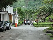
On the grounds of the sugar factory

Danong Dafu Plain Forest Area ( 大 農大 富 平地 森林 園區 )
.jpg)
.jpg)

Web links
Individual evidence
- ↑ 人口 結構 ("Geographical Environment"). Guangfu website, accessed June 28, 2018 (Chinese (Taiwan)).
- ↑ 人口 結構 (“population structure”). Guangfu website, accessed June 28, 2018 (Chinese (Taiwan)).
- ↑ 光復 沿革 ("Review"). Guangfu website, accessed June 28, 2018 (Chinese (Taiwan)).
- ↑ 拒 復興 仁愛 山川 部落 爭 「原」 味 (“Rejection of 'Fuxing' and 'Renai', mountain tribes argue for the 'original' names”). Liberty Times, October 25, 2014, accessed June 29, 2018 (Chinese).
- ↑ 行政 區域 ("administration area"). Guangfu website, accessed June 28, 2018 (Chinese (Taiwan)).
- ↑ 原住民 戶數 及 人數 Households and Persons of Indigenous People. (xls) Taiwan Ministry of the Interior, accessed May 19, 2018 (Chinese / English).
- ↑ 產業 概況 ("Business Overview"). Guangfu website, accessed June 28, 2018 (Chinese (Taiwan)).
- ↑ 交通 位置 ("Traffic situation"). Guangfu website, accessed June 28, 2018 (Chinese (Taiwan)).
- ↑ Matai'an Wetland Ecological Park. 花 東 縱 谷 國家 風景區 (Huatung Valley National Landscape Area), accessed June 30, 2018 .
- ↑ Hualien Sugar Factory. 花 東 縱 谷 國家 風景區 (Huatung Valley National Landscape Area), accessed June 30, 2018 .
