Guiers Vif
| Guiers Vif | ||
|
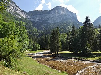
The Guiers Vif about a kilometer below its source |
||
| Data | ||
| Water code | FR : V1510500 | |
| location | France , Auvergne-Rhône-Alpes region | |
| River system | Rhône | |
| Drain over | Guiers → Rhône → Mediterranean | |
| Sources you Guiers | on the municipal boundary of Saint-Pierre-d'Entremont (Isère) and Saint-Pierre-d'Entremont (Savoie) 45 ° 23 ′ 26 ″ N , 5 ° 53 ′ 29 ″ E |
|
| Source height | approx. 1098 m | |
| muzzle | on the municipal boundary of Entre-deux-Guiers and Les Échelles in the Guiers Coordinates: 45 ° 26 ′ 12 ″ N , 5 ° 44 ′ 24 ″ E 45 ° 26 ′ 12 ″ N , 5 ° 44 ′ 24 ″ E |
|
| Mouth height | approx. 378 m | |
| Height difference | approx. 720 m | |
| Bottom slope | approx. 42 ‰ | |
| length | approx. 17 km | |
| Catchment area | 136 km² | |
| Discharge at the Saint-Christophe-sur-Guiers A Eo gauge : 114 km² |
MQ Mq |
4.8 m³ / s 42.1 l / (s km²) |
| Left tributaries | see adjacent table | |
| Right tributaries | see adjacent table | |
|
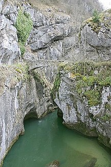
The Guiers Vif in the rocky gorge near Pont Saint-Martin |
||
The Guiers Vif is a river in France that runs in the Auvergne-Rhône-Alpes region . It rises in the Chartreuse Regional Nature Park , on the municipal boundary of Saint-Pierre-d'Entremont (Isère) and Saint-Pierre-d'Entremont (Savoie) , drains generally in a north-westerly direction, and forms the border river between the departments for almost its entire route Isère and Savoie and, after 17 kilometers, flows into the Guiers on the municipal boundary of Entre-deux-Guiers and Les Échelles as a right tributary , which was previously called Guiers Mort . Often the Guiers Vif is not viewed as a tributary, but as the source of the Guiers.
Sources du Guiers Vif
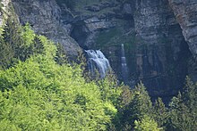
The Guiers Vif rises in the Chartreusegebirge of the karst spring Sources du Guiers Vif (Eng. Quellen des Guiers Vif), on the northern slope of the mountain Lances de Malissard (2045 m). The river emerges from a large cave portal and other small caves and then plunges down three waterfalls and subsequent cascades . The pouring of the spring caves fluctuates strongly. The Guiers Vif runs through sometimes narrow and steep gorges with rock faces.
Tributaries
- Herbetan (left)
- Cozon (right)
- Ruisseau du Vivier (left)
- Ruisseau de Gringalet (right)
- Dixhuitrieux (left)
- Riou Brigoud (left)
- Merderet (right)
- Argenette (right)
Places on the river
(Order in flow direction)
- Saint-Pierre-d'Entremont (Savoie)
- Saint-Pierre-d'Entremont (Isère)
- Saint-Christophe-sur-Guiers
- Les Échelles
- Entre-deux-Chiers
Web links
Individual evidence
- ↑ Source geoportail.gouv.fr
- ↑ estuary geoportail.gouv.fr
- ↑ a b Water information system Service d'Administration National des Données et Référentiels sur l'Eau (French) ( information ), accessed on July 26, 2014, rounded to full kilometers.
- ↑ hydro.eaufrance.fr (station: V1515010 , option: Synthèse ) .


