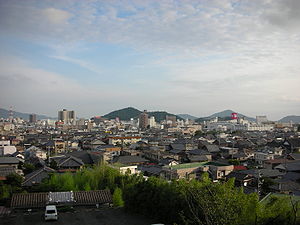
Hofu
| Hōfu-shi 防 府 市 |
||
|---|---|---|
| Geographical location in Japan | ||
|
|
||
| Region : | Chūgoku | |
| Prefecture : | Yamaguchi | |
| Coordinates : | 34 ° 3 ' N , 131 ° 34' E | |
| Basic data | ||
| Surface: | 188.59 km² | |
| Residents : | 114,256 (October 1, 2019) |
|
| Population density : | 606 inhabitants per km² | |
| Community key : | 35206-3 | |
| Symbols | ||
| Flag / coat of arms: | ||
| Tree : | Viburnum awabuki | |
| Flower : | Fire sage | |
| Blooming tree: | Ume | |
| town hall | ||
| Address : |
Hōfu City Hall 7 - 1 , Kotobuki-chō Hōfu -shi Yamaguchi 747-8501 |
|
| Website URL: | http://www.city.hofu.yamaguchi.jp | |
| Location of Hofu's in Yamaguchi Prefecture | ||
Hōfu ( Japanese 防 府 市 , -shi ) is a city in Yamaguchi Prefecture in Japan .
The city was founded on August 25, 1936.
geography
Hōfu is located south of Yamaguchi on the Seto Inland Sea .
Attractions
- Hōfu Tenman-gū ( 防 府 天 満 宮 )
Town twinning
-
 Akitakata , Hiroshima , Japan since July 16, 1971
 -
 Chuncheon , Gangwon-do , South Korea since October 29, 1991
 -
 Monroe , Michigan , United States , since May 29, 1993
sons and daughters of the town
- Nobuko Takagi (* 1946), writer
- Taneda Santōka (1882–1940), haiku writer
traffic
- Street:
- National Road 2 , to Osaka or Kitakyushu
- Train:
- JR Sanyō main line , to Kobe or Shimonoseki
Neighboring cities and communities
Individual evidence
- ↑ 防 府 市 の 姉妹 都市 (安 芸 高田 市) ( Japanese ) Retrieved August 4, 2014.
- ↑ 防 府 市 の 姉妹 都市 (春川 市 ・ 冬 の ソ ナ タ の ロ ケ 地) ( Japanese ) Retrieved August 4, 2014.
- ^ Sister City Hofu Japan. (No longer available online.) Located in: City of Monroe, Michigan. Archived from the original on August 24, 2016 ; accessed on August 24, 2016 . Info: The archive link was inserted automatically and has not yet been checked. Please check the original and archive link according to the instructions and then remove this notice.
Web links
Commons : Hōfu - Collection of images, videos and audio files
- Oidemase Hofu website (Japanese)
- Pictures from the Tenman-gu shrine in Hofu ( Memento from June 21, 2009 in the Internet Archive ) (German)


