Monroe (Michigan)
| Monroe | ||
|---|---|---|
|
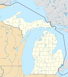
Location in Michigan
|
||
| Basic data | ||
| Foundation : | 1817 | |
| State : | United States | |
| State : | Michigan | |
| County : | Monroe County | |
| Coordinates : | 41 ° 55 ′ N , 83 ° 24 ′ W | |
| Time zone : | Eastern ( UTC − 5 / −4 ) | |
| Residents : | 20,733 (as of 2010) | |
| Population density : | 889.8 inhabitants per km 2 | |
| Area : | 26.2 km 2 (approx. 10 mi 2 ) of which 23.3 km 2 (approx. 9 mi 2 ) land |
|
| Height : | 181 m | |
| Postcodes : | 48161, 48162 | |
| Area code : | +1 734 | |
| FIPS : | 26-55020 | |
| GNIS ID : | 632572 | |
| Website : | www.ci.monroe.mi.us | |
| Mayor : | Robert E. Clark | |
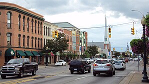
 Monroe, downtown |
||
Monroe is a city in the US state of Michigan . The population was 20,733 at the 2010 census. It is the county seat of Monroe County . The city borders the Monroe Charter Township to the south, but the two cities are not politically dependent on each other. The city is located approximately 14 miles north of Toledo, Ohio and 25 miles south of Detroit . The United States Census Bureau lists Monroe as a middle center in the Monroe-Metropolitan Area, which in 2009 had a population of 152,721. Monroe itself is officially part of the Detroit- Ann Arbor- Flint Combined Statistical Area . Monroe is also sometimes unofficially counted as the northernmost part of the Toledo Metropolitan Area .
Geography and climate
According to the United States Census Bureau, the city has an area of 26.1 km 2 , 23.4 km 2 of which is land and 2.6 km 2 of which is covered by water. Monroe is located at the lowest point in the state of Michigan on the shores of Lake Erie , which is 174 meters above sea level. The average height of the city is 182 meters. The Port of Monroe is the only Lake Erie port in the state of Michigan, and Sterling State Park is the only Michigan State Park's only near Lake Erie. The Raisin and Sandy Creek Rivers flow through Monroe but are not navigable.
Monroe is located in the humid continental climate zone. Monroe has an average of 72.4 cm of snow a year - the lowest average snowfall of any of the state's major cities. July is the warmest month with an average temperature of 29 ° C and January is the coldest month with an average temperature of −9 ° C; extremely high or low temperatures are rare. The lowest measured temperature was −29 ° C on February 5, 1918, the highest measured temperature was 41 ° C on July 24, 1934.
history
The area was first populated by Indian tribes , specifically the Potawatomi, in the late seventeenth century. Robert Cavelier de La Salle claimed the area for New France after his expedition in 1679 with the Le Griffon . In 1784, Francis Navarra received a piece of land south of the Raisin River from the Potawatomi. Frenchtown was founded shortly afterwards as the third European subsidiary in the state. Around the same time, the Sandy Creek Settlement north of Frenchtown was founded by Joseph Porlier Benec.
The area was of strategic importance during the War of 1812 because of its proximity to Detroit, especially after Detroit fell to the warring British in August 1812. The Frenchtown area served as a springboard for American forces to retake Detroit, leading to the devastating Battle of Frenchtown in January 1813.
American forces were camping in the area with the intent of retaking Detroit when they encountered British and Native American forces near the banks of the Raisin River on January 18. Originally, under the command of James Winchester, the Americans fought down British and Indian troops. The battle was later dubbed the First Battle of the River Raisin. Four days later, however, the Americans counterattacked at the same location. Many of the Americans were injured from the previous fighting and their escape routes were cut off. The British, commanded by Henry Proctor under, and their Indian allies killed nearly 400 American soldiers in the so-called Battle of Frenchtown . The surviving Americans became prisoners of war , but some were later killed by Indian forces in the so-called River Raisin massacre . Today the site of the battle is home to a visitor center and the River Raisin National Battlefield Park.
The Frenchtown area was renamed Monroe in honor of President James Monroe who visited the Michigan Territory in 1817. In the same year the city became the county seat of the newly created Monroe County.
Monroe is known as the place where General George Armstrong Custer grew up , where he later met and married Elizabeth Bacon. In his honor, President William Howard Taft and the widowed Elisabeth Bacon inaugurated an equestrian statue of Custer in 1910 , which now stands on the corner of Elm Street and Monroe Street. Custer is namesake of streets, various historical sites, buildings, schools and the Custer Airport. Monroe is also called the home of General Custer.
The company La-Z-Boy was founded in Monroe in 1927, which even today is headquartered in Monroe. In 1974 the Monroe Power Plant was built, now the fourth largest coal -fired power plant in North America. The two 245-meter-high chimneys can still be seen from a distance of over 40 kilometers and are among the tallest structures in the country.
Demographics
According to the 2010 census , 20,733 people lived in 8,238 households and 5,277 families in the city. The population density was 890 inhabitants per km². There were 9158 housing units at an average density of 385.6 housing units per km².
There were 8,238 households in which children under the age of 18 were living in 31.5% of the cases, 41.7% were married couples living together, 17.1% had a female head of the household without a husband, and 35.9% were non-families. 30.6% of all households were single households and there were people living in 10.6% who were 65 years of age or older. The average household size was 2.44 and the average family size was 3.05.
26.2% of the population was under 18 years old, 9.0% was 18 to 24 years old, 29.5% was 25 to 44 years old, 25.4% was 45 to 64 years old, and 13.3% was 65 years or older. The median age was 36.3 years. 53.0% of the population were female.
The median income for a household in the city was $ 41,810, and the median income for a family was $ 51,442, according to the 2000 census . Males had a median income of $ 42,881 versus $ 25,816 for females. The city's per capita income was $ 19,948. 9.0% of families and 12.6% of the population were below the poverty line, of whom 15.0% were under 18 years of age and 16.1% were 65 or older.
sons and daughters of the town
- Elisha P. Ferry (1825–1895), politician (Republican Party)
- John C. Lehr (1878–1958), politician
- Otis Howard Green (1898–1978), Romanist and Hispanicist
- Dutch Lauer (1898–1978), American football player
- Vern Sneider (1916-1981), author
- Christie Brinkley (* 1954), model as well as an actress, designer and activist
- Tonya Kinzinger (* 1968), actress
- Bronco McKart (* 1971), professional boxer
- Jacob Sacks (* 1977), jazz pianist
- James Ilgenfritz (* 1978), jazz and improvisation musician
- Carl Ford (born 1980), football player
