
Harbor West
|
Harbor West
Coordinates: 50 ° 1 ′ 38 ″ N , 10 ° 13 ′ 34 ″ E
|
|
|---|---|
| Height : | 208 m above sea level NN |
| Area : | 1.47 km² |
| Residents : | 22 (Dec. 31, 2015) |
| Population density : | 15 inhabitants / km² |
| Postal code : | 97424 |
| Area code : | 09721 |
 Hafen-West district (District 52)
|
|
 Mainhafen in the west of the harbor
|
|
The port-West (place name: in Port-West ) is a district of the independent city of Schweinfurt in Lower Franconia . It is listed as District 52 in the statistics of the city of Schweinfurt. Hafen-West is exclusively an almost uninhabited port and industrial area and, together with neighboring districts, forms one of the largest contiguous industrial and commercial areas in Bavaria .
location
Hafen-West is located south of the Main in the district of Oberndorf . The district has almost the shape of an equilateral triangle and is bounded by the Main in the northwest, the B 286 in the northeast and the A 70 in the south .
The Hafen-West (1.5 km²) together with the adjoining Hafen-Ost (2.0 km²), the industrial and commercial park Maintal (1.5 km²), the industrial area north of the Main (1.0 km²), the Sennfelder Hafen (0.3 km²) and the subsequent industrial and commercial area, which also belongs to Sennfeld, including Carl Kühne KG (0.1 km²) with 6 km² one of the largest contiguous industrial and commercial areas in Bavaria . It has the same area as z. B. the Volkswagen plant in Wolfsburg .
history
The area of today's district originally belonged to the municipality of Oberndorf, which was incorporated into Schweinfurt in 1919 . The entire area is therefore still part of the Oberndorf district . The area was uninhabited and undeveloped until the early 1960s, was used for agriculture and was partially flooded by the Main.
The industrial areas north of the Main became scarce in the early 1960s. That is why the Hafen-West was created as a new district or new industrial area from 1963 on the Oberndorf district, in the course of the so-called jump over the Main . The first construction project was the actual port on the major shipping route Rhine-Main-Danube Canal . The construction work for this began in 1961 and the port handling in 1963. From then on, the industrial area was gradually built.
Economy and Infrastructure
Established businesses
- Bosch Rexroth
- Erik Walther , mineral oil company
- Fresenius Medical Care , with Technology Center from the end of 2019.
- Schweinfurt joint power plant (GKS)
- Ireks malt
- SKF , among other things, with the world's most powerful large bearing test center.
- ZF Friedrichshafen AG , formerly Fichtel & Sachs , including a development center
Authorities
- Port administration
traffic
-
Federal motorway 70
- Junction number 6: Schweinfurt harbor
- Junction number 7: Schweinfurt center
-
Bundesstrasse 286
- Connection point Hafenkreuz
- City bus route 62
- Main harbor on the Rhine-Main-Danube Canal
- Port and industrial rail connections
Social structure
| Status December 31, 2015 |
Harbor West | The entire Schweinfurt area |
|---|---|---|
| German | 45.5% | 70.7% |
| Dual nationals | 4.5% | 16.1% |
| Foreigners | 50.0% | 13.2% |
The statistical values of the social structure are not meaningful because of the very small number of inhabitants and the rather random composition of residents in an industrial area.
Attractions
The Hafen-West forms a shop window for business, with an impressive sea of lights at night, overlooked by the skyscraper of the German SKF headquarters on the opposite (north) side of the Main, with one of the largest neon signs in the world.
Picture gallery
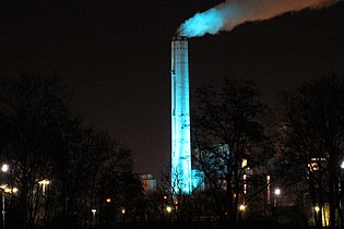
Chimney of the GKS at night

Ireks malt

Development center
ZF Friedrichshafen AG
Roentgenstrasse

TMS Thuringia and TSL Marie Luise
from Erik Walther


Videos
- Video: RT Video and Photography Reiner Then: With the city bus through the harbor and Luitpoldstrasse (4:24)
- Video: Aerial photos360: Schweinfurt industrial area from the air (2:10)
Individual evidence
- ↑ Measured using the BayernAtlas
- ↑ Information about the city of Schweinfurt
- ↑ Overview map of the districts. Retrieved December 19, 2017 .
- ^ History of the City of Schweinfurt, Official City Map Schweinfurt, 23rd edition
- ↑ mainpost.de: "The port that connects the Main with rail and road" , March 13, 2019. Retrieved on March 14, 2019 .
- ↑ TVM: Commitment to the location - Fresenius is building a new technology center in Schweinfurt (video 1:52 min.). Retrieved October 30, 2018 .
- ↑ SKF Large Bearing Test Center: Computer animation (video 2:20 min.). Retrieved May 1, 2018 .
- ↑ Population register-based
- ↑ Stern / View: Hafen-West at night. Retrieved June 24, 2018 .