Halabiya
Coordinates: 35 ° 41 ′ N , 39 ° 49 ′ E
Halabiya , Arabic حلبية, DMG Ḥalabiyya , also Halabiye, Zenobia; was a fortified city on the Euphrates in Syria , the founding of which is attributed to the Palmyrenean ruler Zenobia around 270 AD. Most of the ruins that are visible today date from the 6th century, when the Byzantine Emperor Justinian had the city restored and expanded.
location
Halabiya is located on the right (here western) bank of the Euphrates between ar-Raqqa and Deir ez-Zor in the Deir ez-Zor governorate . After about 75 kilometers from the expressway south of the Euphrates, a side road branches off in a northerly direction shortly before the village of at-Tibnī and leads along the river and through irrigated fields of the Euphrataue to the ruins after eight kilometers. The Zalabiya fortress ruins , two kilometers downstream on the left bank of the Euphrates, can be reached from here via a pontoon bridge.
The Euphrates valley, which is dug into the Syrian desert steppe, narrows to a few hundred meters near Halabiya. On the west bank, the steep gypsum embankment of the hills with little vegetation extends directly to the Euphrates. At the twin fortress of Zalabiya, the Euphrates makes an arc at the al-Khanuqa ("the strangler") strait, and then flows again through a plain several kilometers wide. Both positions were ideally located in Roman times to control the important traffic connection on the river and the road running parallel to it from an elevated position . In the 2nd and 3rd centuries AD , a number of fortresses and military camps were founded on a line along the Euphrates, which formed the border with the Parthian and Sassanid Empire , in whose strategic concept Halabiya was incorporated. In the immediate vicinity there were Sura and Callinicum (today overbuilt by the city of ar-Raqqa) to the northwest . In Sura, coming from Palmyra via Resafa , the late Roman border and trade route Strata Diocletiana merged into the road on the Euphrates. Southeast of Halabiya followed first stations Tibne, then 28 kilometers away from Halabiya taboo and further Qreiye at-Ayyash (16 kilometers north-east taboo). These were only fortified guards and were much smaller than Halabiya.
history
- For the pre-Roman history of the place see Zalabiya .
The Euphrates represented the shortest connection between the Sassanid Empire and the Roman provinces. The Romans therefore tried to extend their control along the river to the east and beyond Dura Europos . After many of the Roman military camps had been destroyed in an attack by the Persian King Shapur I , the general Septimius Odaenathus from Palmyra succeeded in pushing back Shapur and restoring Roman order in the east. After his death in 267 his wife Zenobia took over the rule for the still underage son Vaballathus . Zenobia renounced the Roman Empire and in a short time conquered large areas in Asia Minor until Palmyra was captured by Emperor Aurelian in August 271 and Zenobia was taken captive.
During this time of political expansion and economic prosperity of Palmyra, the expansion of Halabiya fell as a necessary defense against the Sassanids. Halabiya was possibly intended as a replacement for the 256/257 destroyed by the Sassanids Dura Europos. According to the Roman historian Prokop , Zenobia had the fortress built. This is very likely a later attribution to the regent's rule, which lasted only five years. The fortress is likely to have existed before.
After Zenobia was ousted, the Romans took over the eastern outpost. Emperor Diocletian (r. 284–305) had the walls reinforced because Halabiya was included in the Roman line of defense of the Limes Arabicus . There was further construction activity under the Eastern Roman Emperor Anastasios I (r. 491-518). The city and the fortification walls were severely damaged by several attacks by the Sassanid king Chosrau I. In the time of Justinian I (r. 527-565) around 550 the city walls of Halabiya as well as those of Resafa were rebuilt and strengthened. Prokop also describes the construction of the citadel, two churches and a military camp.
In 610, Chosrau II (r. 590–628) conquered and destroyed the city at the beginning of years of military campaigns in the Middle East. After that it lost its importance to a large extent and after the Arab occupation in 637 completely. Fortification was no longer strategically necessary within an Abbasid caliphate. The last traces of settlement date from the 12th century.
Excavations
The first surveys and excavations were carried out in 1936 by a team from Yale University . From 1944 to 1945, the French archaeologist Jean Lauffray uncovered some buildings that were just below the surface and tried to determine the time of the finds by comparing styles. Since 2006, excavations have been taking place again in a Franco-Syrian collaboration between the University of Montpellier and the General Directorate for Antiques and Museums in Damascus. The aim is to get a more precise chronological dating of the construction phases and an idea of the Roman cityscape.
Cityscape
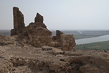
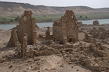
The 12 hectare urban area from the Justinian era has the shape of a triangle that adapts to the steep terrain and narrows from the side on the river bank to the citadel high on the hilltop. The city was surrounded on all three sides by a fortification wall. On the 385-meter-long side of the river, this was largely eroded over time by flooding, although Justinian had it secured against flooding by a protective wall. The 550-meter-long city wall in the south and 350 meters in the north was secured during the most recent Franco-Syrian research project and large parts of it were restored. It has been preserved at a height of 8 to 15 meters. The fortification wall is three meters wide and consists on both sides of a shell made of coarse gypsum blocks and inside a filling compound that contains gypsum stone and basalt fragments. Today a small asphalt road leads along the river bank through gaps in the wall. The two city gates on the Roman Euphrates route are a few meters from this new road. The gates were protected by cantilevered towers on the sides. Small remains of three other city gates on the river bank are still there. Throughout the entire course, the city wall was reinforced at regular intervals with towers protruding on both sides. On the outside these are provided with loopholes, while in the half protruding towards the city side a staircase leads up to the upper walkway.
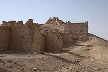
At the top of the city triangle, at the highest point, is the citadel, which was partially rebuilt in Arab times. The citadel extends to the west over the city walls that rise up on the side of the slope and overbuilds the narrow, steeply sloping plateau on all sides. Some parts of the wall on the first floor have been preserved.
On the steep slope a few meters northwest below the citadel is the praetorium integrated into the course of the wall , a monumental rectangular building whose three floors could be reached via long straight stairs. The two main rooms, one above the other, were only supported by two massive pillars in the middle, on which the cross ridges of the vault congregated. This resulted in a subdivision into six square domed rooms. The cross arches of two floors are still preserved, the missing vaulted ceilings allow a view upwards. A clear building structure that focuses on the essentials remains recognizable, which, like the uniformly designed wall towers, fits the carefully planned concept of the entire city complex. With this, Halabiya differs significantly from Resafa, whose various towers of the city wall, which are arranged at unequal intervals, make it probable that it was built a year earlier than Halabiya.
The central urban area on the level was also planned uniformly and structured by main streets running at right angles to each other. However, it is much worse preserved. The buildings were mainly constructed from crystalline plasterboard blocks with wide clay joints. The wall material comes from two quarries at the top of the hill just outside the city walls. The brittle gypsum stone tends to form cracks with temperature differences.
A street of columns ran between the north and south gates. On the side facing the river, there were no longer recognizable baths and a palaestra . Other public buildings with stone paving floors and pillared porches were uncovered here and near the southern city wall between 2007 and 2009. A central forum and two basilicas were located on the colonnaded street branching off at right angles to the west . Parts of the apse and the east wall of the higher northwest basilica are upright.
The small remains of the east basilica were sufficient to reconstruct its basic plan. The three nave Pfeilerbasilika had three yokes in the main room, and a semi-circular apse with rectangular side rooms on both sides. The central nave was largely filled with a U-shaped border . The clergy sat on this raised platform, which was characteristic of many Syrian churches in the early Byzantine period .
The only visible remains from the late Roman period are burial towers that are one kilometer north of the city on the banks of the Euphrates and there are some burial chambers , to which a staircase leads down. Another three-story tower is south of the city. The 14 grave towers with thick walls made of rubble stones with a lot of lime mortar are similar to those in Palmyra. A narrow staircase led around the interior burial niches to the upper floors.
literature
- Jean Lauffray: Halabiyya-Zenobia. Place forte du limes oriental et la haute Mésopotamie au VIème siècle, V. I, Les duchés frontaliers de Mésopotamie et les fortifications de Zénobia. Geuthner, Paris 1983.
- Jean Lauffray: Halabiyya-Zenobia. Place forte du limes oriental et la haute Mésopotamie au VIème siècle, V.II, L'architecture publique, privée et funéraire. Geuthner, Paris 1991
- Frank Rainer Scheck, Johannes Odenthal: Syria. High cultures between the Mediterranean and the Arabian desert. DuMont, Cologne 1998, pp. 338-340
Web links
- Syria - Zenobia-Halabiya. France diplomacy
- Zenobia / Wall / Euphrates. Kiel Image Database Middle East, Christian Albrechts University Kiel
- Zenobia (Halebiye). at Livius.org
- Programs d'études archéologiques et de consolidations sur le site de Zénobia-Halabiyé. CRISES excavations at the University of Montpellier from 2007 to 2009
Individual evidence
- ↑ Prokop, De bello Persico 2, 5, 4; De aedificiis 2, 8, 8f.
- ^ Warwick Ball: Rome in the East. The Transformation of an Empire. Routledge, London / New York 2000, p. 165
- ^ The scientific goals of the mission. France diplomacy


