Halberg (Bad Laasphe)
| Halberg | ||
|---|---|---|
|
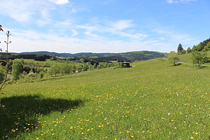
View from the Spreitzkopf south slope at the K 36 (right) to |
||
| height | 495.2 m above sea level NHN | |
| location | at Hesselbach ; District of Siegen-Wittgenstein , North Rhine-Westphalia ( Germany ) | |
| Mountains | Rothaar Mountains | |
| Coordinates | 50 ° 52 '50 " N , 8 ° 22' 10" E | |
|
|
||
The Halberg is 495.2 m above sea level. NHN high foothills of the Weisgesberg ( 536.1 m ) in the Rothaargebirge . It is located in the district of Hesselbach in the urban area of Bad Laasphe in the North Rhine-Westphalian district of Siegen-Wittgenstein .
geography
location
The Halberg rises in the southeast of the Sauerland-Rothaargebirge nature park . Its summit is 550 m south of Hesselbach and 1.4 km northeast of Fischelbach . The Hesselbach flows past to the north and flows into the Banfe at its western neighbor Großer Bohnstein ( 500.5 m ) .
Parts of the Bad Laasphe landscape protection area are located on the partially forested Halberg (CDDA no. 390391; designated in 1987; 113.3714 km² in size).
Natural allocation
The Halberg belongs in the natural spatial main unit group Süderbergland (No. 33) and in the main unit Rothaargebirge (with Hochsauerland) (333) to the subunit Südwittgensteiner Bergland ( Wittgensteiner Lahnbergland ; 333.2).
Mountain height
The Halberg is 495.2 m high; its main summit is 700 m north of the Weisgesberg summit. A 494.2 m high point is marked on the German basic map near the Halberg summit . A little to the north of it are three other places with heights of 493.6 m , 492.6 m and (in between) 491.2 m .
Transport links and sports field
District roads 36 and 37 lead through the valley of the Hesselbach north of the Halberg . In the local village of Hesselbach, the K 37 meets the K 36 coming from Bad Laasphe, which leads below the village to the mouth of the Hesselbach in the Banfe and shortly afterwards meets the state road 718 (Fischelbach- Banfe ). The street Am Halberg branches off from the K 37 in Hesselbach , which leads as a cul-de-sac to the Halberg Arena , an artificial turf sports field with a clubhouse operated by SV Oberes Banfetal , about 250 m northwest of the Halberg summit at an altitude of 478.4 m .
Individual evidence
- ↑ a b c d Map services of the Federal Agency for Nature Conservation ( information )
- ^ Gerhard Sandner: Geographical land survey: The natural space units on sheet 125 Marburg. Federal Institute for Regional Studies, Bad Godesberg 1960. → Online map (PDF; 4.9 MB)
- ↑ a b c Topographical Information Management, Cologne District Government, Department GEObasis NRW ( information )

