
Hambach (Lahn)
| Hambach | ||
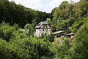
 The Hambach near Aull |
||
| Data | ||
| Water code | DE : 258794 | |
| location |
Giessen-Koblenz Lahntal
|
|
| River system | Rhine | |
| Drain over | Lahn → Rhine → North Sea | |
| source | at Eppenrod 50 ° 24 ′ 7 ″ N , 7 ° 56 ′ 43 ″ E |
|
| Source height | approx. 275 m above sea level NHN | |
| muzzle |
Aull in the Lahn coordinates: 50 ° 23 ′ 6 ″ N , 8 ° 0 ′ 20 ″ E 50 ° 23 ′ 6 ″ N , 8 ° 0 ′ 20 ″ E |
|
| Mouth height | approx. 110 m above sea level NHN | |
| Height difference | approx. 165 m | |
| Bottom slope | approx. 26 ‰ | |
| length | 6.4 km | |
| Catchment area | 11.669 km² | |
The Hambach is a six kilometer long and right tributary of the Lahn near Aull . It flows through the Rhineland-Palatinate districts Rhein-Lahn-Kreis and Westerwaldkreis .
geography
course
The Hambach rises about 750 m southeast of the center of Eppenrod in the Rhein-Lahn district. It then flows northeast into the Westerwaldkreis to the municipality of Görgeshausen . About 200 m south of the village, it turns to the southeast, runs along the Görgeshausen mill and returns to the Rhein-Lahn district, where it initially flows through the center of the Hambach community . Flowing further to the south-east, the Hambach then reaches the community of Aull , where it first flows around the Alte Burg , before flowing into the Lahn after the center of Aull a little later .
The Görgeshausen mill on Hambach

The Hambach in Aull
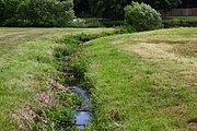
The tributary of the Hambach into the Lahn near Aull


Tributaries
- Pumping station ditch (from the left, south of Görgeshausen, approx. 320 m, GKZ 2587942)
- Kelterbaumbach (from the left, north of Hambach, approx. 1.6 km, GKZ 2587944)
- Rollsbach (from the right, south of Hambach, approx. 1.4 km, GKZ 2587946)
Web links
Individual evidence
- ↑ a b topographic-map.com
- ↑ a b Rhineland-Palatinate Water Management Authority