Hehlberg
| Hehlberg | ||
|---|---|---|
|
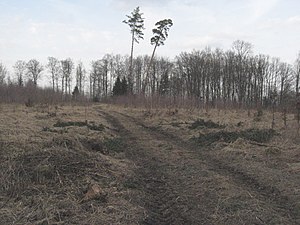
The southeastern Hehlberg plateau in late winter 2011 |
||
| height | 504.4 m above sea level NHN | |
| location |
Baden-Württemberg
|
|
| Mountains | Limpurger Mountains | |
| Dominance | 1.4 km → Rauher Berg | |
| Notch height | 57.1 m | |
| Coordinates | 49 ° 5 '12 " N , 9 ° 49' 31" E | |
| Topo map | Geoportal Baden-Württemberg | |
|
|
||
| rock | Mittelkeuper , sandstone plateau ( Hassberge formation ) | |
The Hehlberg is an elevation on the edge of the northern Limpurger Mountains near Schwäbisch Hall- Sulzdorf in northeastern Baden-Württemberg .
location
The Hehlberg rises about two kilometers southwest of the village center of Sulzdorf up to 504.4 m above sea level. NHN . Its small plateau is about 110 m above the plain around Sulzdorf in the northeast and about 80 m above the valley floor of the uppermost Fischach in the southwest. In its north it is part of the smaller eastern branch of the Limpurger Mountains between Fischachtal in the southwest and Bühlertal in the northeast. This chain of mountains and hills begins at the flat, northeastern foothills of the Limpurger Mountains, the Sulzdorfer / Hessentaler Hasenbühl , and initially extends in a small mountain range of Bauernschnäue ( 512.4 m above sea level ), Rauhem Berg ( 508.5 m above sea level) ), Neuberg ( 499.4 m above sea level ) and finally Hehlberg ( 504.4 m above sea level ) to the west around the erosion bay of the Sulzdorf Schwarzenlachenbach brook. In the further course it reaches two more heights above 470 m above sea level. NN and then remains until the mouth spur between Fischach and Bühlertal about 9 km further in the southeast, with which it runs out, always below 450 m above sea level. NN .
Shape and nature
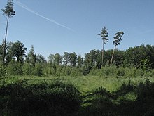
The secret of the mountain has an approximately 6 hectares, roughly oval and waterlogged gravel sandstone -Hochfläche that currently carries in its northwestern half oak-beech mixed forest. The other is almost only on the edge of trees and shows new growth of pioneer trees, especially birches, in the interior without a high trunk. The mostly loamy slopes of the mountain fall quite steeply at the beginning, flatter at the foot and are forested. It is separated from Neuberg , immediately adjacent to the west , by a small pass about 57 m lower, through which a good forest path leads south from the Sulzdorfer Schwarzenlache into the upper Fischachtal. On its south-east side, the small reed sandstone ridge of the Birkentöbel continues the mountain range about 30 m lower, initially flat to the south, over the beginning of which another developed dirt road runs from the K 2627 Sulzdorf-Herlebach. From its highest point, a short climb climbs the plateau of the Hehlberg and then continues up as a grass path, in which the water is often in pits.
history
On the southeast slope of the mountain next to the forest road there is grave radicals have received from the once here toward the Birkentöbeles pulling Haller Landheeg .
Individual evidence
- ↑ Map services of the Federal Agency for Nature Conservation ( information )
- ↑ As of 2011.
- ^ Name of the settlement area
literature
- Topographic map 1: 25,000 Baden-Württemberg North, single sheet cut No. 6924 Gaildorf and 6925 Obersontheim.
- Hans Mattern , Reinhard Wolf : The Haller Landheg . Thorbecke, Sigmaringen 1990, ISBN 3-7995-7635-5 ( Research from Württembergisch Franconia . Volume 35).


