Sulzdorf (Schwäbisch Hall)
|
Sulzdorf
City of Schwäbisch Hall
|
|
|---|---|
| Coordinates: 49 ° 6 ′ 11 ″ N , 9 ° 50 ′ 19 ″ E | |
| Height : | 381 m above sea level NN |
| Area : | 19.45 km² |
| Residents : | 2802 (Dec. 31, 2012) |
| Population density : | 144 inhabitants / km² |
| Incorporation : | January 1, 1972 |
| Postal code : | 74523 |
| Area code : | 07907 |
|
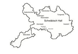
Districts of Schwäbisch Hall, Sulzdorf in the east
|
|
|
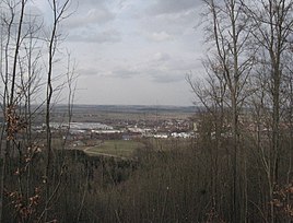
View from Hehlberg to the north on the industrial zone of Sulzdorf
|
|
Sulzdorf is the easternmost district of Schwäbisch Hall in the district of the same name in north-eastern Baden-Württemberg .
geography
Sulzdorf occupies the left outer part of the step edge bay, which the river Bühler created when it exited the Keuperberge in the north of the Hohenlohe plain . The district extends roughly from the northeastern edge of the Limpurger Mountains in the west to the deeply cut valley of the Bühler in the east and from near the narrow bay near Vellberg in the south to the course of the left Bühler tributary Otterbach in the north.
The eponymous village Sulzdorf is the most heavily populated main town of the formerly independent municipality. Sulzdorf is located about 7.5 km east- south- east of the city center of Hall, close to an arch of wooded marginal mountains, the flat Heidelberg in the south, the Hehlberg in the south-west, the Neuer Berg , the Rauhenberg in the west- south- west and the Bauernschnäue in the west (the latter is set back in the Hessental district ), which then - with the Limpurger Mountains themselves - runs northward into the plain in the flatter sloping hillside forest Hasenbühl . On the slopes of this forest amphitheater , the Schwarzenlachenbach , also known as the Schwarze Lache , rises in several spring branches from small clay gullies , which, after they have merged, enters the commercial zone of the village in a north-easterly direction, then runs east in the meanwhile deeply deepened valley through the old town center and behind the settlement boundary in a partially wooded Muschelkalk - blade continues towards its confluence with the Bühler near Anhausen.
Sulzdorf's settlement core lies in the valley basin of the village stream Schwarze Lache and on both sides of the valley slopes and on the left shoulder of the slope; the church stands on this. With the construction of the railway, the village got a train station west of the edge of the settlement, on which other buildings were then erected, including the high-rise warehouse of a rural cooperative, which can be seen from afar. From the 20th century, large housing estates developed on the outskirts on both sides of the valley trough, first in a triangle between Hauptstraße, Herdweg and the railway line in the southwest, then in the church fields northwest and north of the church, and finally in the garden and blade fields in the east on both sides the downward ridge of the valley. Towards the end of the 20th century, after the incorporation into Hall, the industrial zone grew strongly; it now stretches in an approximately 500 meter wide strip with some gaps between the railway line and Bühlertalsstraße L 1060 from the south to the west.
In addition to Sulzdorf itself, the district also includes a few significantly smaller hamlets that are still dominated by agriculture today.
- Buch is located about one and a half kilometers east-southeast of the village outskirts on the left shoulder of the Bühlertal on a side road to Vellberg.
- Dörrenzimmern is about a kilometer southeast of the southern tip of the village on Bühlertalstrasse and on the upper Hirtenbach .
- Matheshörlebach is about one kilometer north-northwest of the village outskirts on the road to Tüngental.
- Jagstrot is about one and a half kilometers north-northeast of the edge of the village, from here, after two side roads converge, a valley trail leads down into the Bühlertal.
- Hohenstadt is just as far northeast directly above the Bühlertal. At his feet, next to the river, is the Neunbronn mill .
- Anhausen is less than one and a half kilometers east of the edge of the village at the mouth of the Schwarzenlachenbach.
history
The place was probably founded in the 7th century; the first recorded mentions come from the second half of the 10th century. The Comburg donation book records Knights von Sulzdorf for the 11th century, but their coat of arms and the seat of their castle could not be determined later. The place belonged to the property of the Counts of Comburg-Rothenburg. These donated property to the Comburg monastery . In the Middle Ages, the Limpurg taverns and families from the town nobility of Hall also owned Sulzdorf.
In the course of the 16th century, the imperial city of Hall gradually acquired almost all of the rulership rights over Sulzdorf, which is why the inhabitants became Protestant in the course of the Reformation. The community was thus part of the Haller land territory and was subordinated to the Halle office (In der) Schlicht .
In 1670 a large part of the town burned down; For a long time, the image of Sulzdorf was shaped by the half-timbered farms that were erected after this event.
After the imperial city was dissolved and the Hall territories were taken over by Württemberg in 1802, the community belonged to the newly established Württemberg Oberamt Hall , from which the Hall district emerged in 1934 and the Schwäbisch Hall district in 1941.
During the community reform, Sulzdorf was incorporated into Schwäbisch Hall on January 1, 1972 with the associated hamlets Matheshörlebach , Jagstrot , Hohenstadt , Anhausen , Buch , Dörrenzimmern and Neunbronn .
In December 2012 Sulzdorf had 2802 inhabitants.
Infrastructure
Sulzdorf has two municipal kindergartens, a primary school and a Protestant church including a community center. There are also sports facilities, doctors, banks and grocery stores on site.
traffic
Sulzdorf is on the L 1060 and on the Crailsheim – Heilbronn railway line . Buses 5, 12, 17 and 18 of the Schwäbisch Hall roundabout serve stops in the district. Today no trains stop at the former train station in town.
Attractions
- St. Margaret's Church of the Protestant parish of Sulzdorf
literature
- State of the imperial city of Halle in Swabia . In: Latest State Ads . Second volume. Mutzenbecher, 1797, ZDB -ID 525800-5 , p. 490–497 ( p. 490 in Google Book Search).
Individual evidence
- ↑ a b statistics on www.schwaebischhall.de
- ↑ a b Eugen Gradmann : The art and antiquity monuments of the city and the Oberamt Schwäbisch-Hall . Paul Neff Verlag, Esslingen a. N. 1907, OCLC 31518382 , pp. 172 ( archive.org ).
- ↑ a b The history of Sulzdorf on www.schwaebischhall.de
- ^ Federal Statistical Office (ed.): Historical municipality directory for the Federal Republic of Germany. Name, border and key number changes in municipalities, counties and administrative districts from May 27, 1970 to December 31, 1982 . W. Kohlhammer, Stuttgart / Mainz 1983, ISBN 3-17-003263-1 , p. 456 .
- ↑ a b Citizen information on Sulzdorf on schwaebischhall.de
Web links
- Map from Sulzdorf to: State Institute for the Environment Baden-Württemberg (LUBW) ( Notes )
- List of sub-locations on the website of the city of Schwäbisch Hall


