Heukenberg
| Heukenberg | ||
|---|---|---|
|
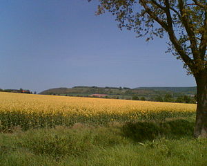
The Heukenberg is characterized by grassland interspersed with bushes in places. |
||
| height | 349 m | |
| location | Merxhausen , Lower Saxony | |
| Mountains | Weser-Leine-Bergland , Lower Saxony Bergland | |
| Coordinates | 51 ° 49 '42 " N , 9 ° 38' 48" E | |
|
|
||
The Heukenberg is a 349 m high elevation in the Solling foreland near Merxhausen in Lower Saxony .
Location and surroundings
The Heukenberg is east of the Solling , west of the Amtsberge . Merxhausen is at its southwestern foot and the Spüligbach also flows along here. Its northern foothills come close to Heinade , the southern to Mackensen . The municipal boundaries of Heinade and Dassel run across this elevation, which also corresponds to the district boundary between the district of Holzminden and the district of Northeim .
Flora and nature protection
Small-scale biotopes with species worth protecting result in a harmonious landscape , which is therefore largely designated as the Heukenberg nature reserve, as well as an FFH area in combination with the Holzberg . The semi -arid grassland is particularly rich in species . In addition, there are grassland areas, some of which are covered with wood. The extensive agriculture here supports the preservation of local diversity.
Origin of names and legends
The name Heukenberg, in older versions also Häukenberg or Hödekenberg , is derived from Hödeken , a goblin-like legendary figure who is said to have lived here. According to a legend, the Heukenberg is said to have been haunted until a clergyman managed to banish the ghost from a fish in the nearby stream.
According to another etymological interpretation, the name can be traced back to an earlier use as a grazing area for goats ( Low German : hoiken).
Web link
Individual evidence
- ↑ Federal Agency for Cartography and Geodesy, Land Surveying and Geographic Base Information Lower Saxony: Digital Topographic Map 1:50 000, Lower Saxony Navigator accessed on March 30, 2011
- ↑ nlwkn.niedersachsen.de NLWKN accessed on March 30, 2011
- ^ Adalbert Kuhn: Spook on the Heukenberge . In: Legends, customs and fairy tales from Westphalia: and some others, especially the neighboring areas of northern Germany . tape 1 . FA Brockhaus, Leipzig 1859, p. 349-351 ( Google Books ).
- ↑ Hans-Norbert Mittendorf: On the cultural history of today's Dassel urban area in the mirror of old field names . 1991, p. 125
- ↑ Edeltraud Knetschke: Neck and ankle in German word geography . 1956, p. 88

