Hintereggkogel
| Hintereggkogel | ||
|---|---|---|
|
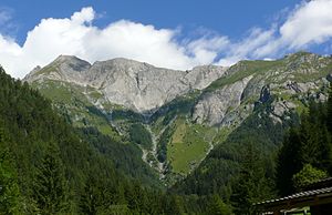
Ochsenbug with wooden wall and Hintereggkogel (from left to right) from the south |
||
| height | 2638 m above sea level A. | |
| location | East Tyrol | |
| Mountains | Frosnitzkamm , Venediger Group | |
| Coordinates | 47 ° 1 '46 " N , 12 ° 29' 41" E | |
|
|
||
| First ascent | unknown | |
| Normal way | from Zedlach via the south climb ( I ) | |
The Hintereggkogel , also Hinteregger Kogel or Feldkögele , is 2638 m above sea level. A. high mountain peak in the Frosnitzkamm of the Venediger group in the north of East Tyrol .
location
The Hintereggkogel is located in the east of the Venediger group or in the extreme east of the Frosnitzkamm on the municipality border between Matrei in East Tyrol in the south-east and Virgen in the south-west. The summit area is located just inside the Hohe Tauern National Park (core zone). The Hintereggkogel forms the end of the Frosnitzkamm in the east, with the Hintereggkogel falling over the Zedlacher Wiesen to the east into the Tauern valley. The southern ridge of the Hintereggkogel falls over the Planissbichl ( 2160 m above sea level ) to the Wodenalm and the Zedlacher Paradies , in the north there is the Nuenitzköpfl ( 2028 m above sea level ) and the valley of the Frosnitzbach . The Frosnitzkamm runs to the west from the Hintereggkogel to the Bretterwand .
Promotion opportunities
The normal route to the Hintereggkogel starts in the Matrei village of Zedlach . From Zedlach you get to the Wodenalm via the Zedlacher Paradies, from which you climb over the Zedlacher meadows to the Planissbichl (also called Zedlacher Wiesenkopf ). The further ascent follows the ridge, which leads to the Hohes Feld elevation . The Hintereggkogel can be reached from the Hohe Feld via a few rocks ( I ). As an alternative ascent route, it is possible to climb the east ridge from the Matrei village of Hinteregg ( III- ).
Individual evidence
- ↑ AV Guide
- ^ Federal Office for Metrology and Surveying Austria: Austrian Map online (Austrian map 1: 50,000) ; according to TIRIS 2637 meters
literature
- Willi End , Hubert Peterka : Alpine Club Leader Venediger Group. Bergverlag Rother , 5th edition 2006, ISBN 3-7633-1242-0 , p. 290.
- Alpine Club Map 1: 25,000, sheet 36, Venediger Group , ISBN 3-928777-49-1 .

