Hittisberg
| Hittisberg | ||
|---|---|---|
|
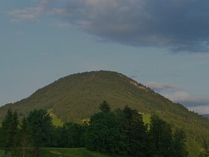
The Hittisberg as seen from Hittisau. |
||
| height | 1328 m above sea level A. | |
| location | Hittisau , Vorarlberg , Austria | |
| Mountains | Allgäu pre-Alps west of the Iller | |
| Dominance | 2.6 km → Koppachstein | |
| Notch height | 300 m ↓ Genabend ( notch to Renkknie ) | |
| Coordinates | 47 ° 26 '51 " N , 9 ° 59' 24" E | |
|
|
||
| rock | Nagelfluh | |
| Normal way | Hiking trail from Hittisau | |
The Hittisberg is a 1328 m above sea level. A. high mountain of the Allgäu pre-Alps west of the Iller . It lies entirely in the area of the municipality of Hittisau .
Location and surroundings
The Hittisberg lies between Bolgenach and Subersach , east of the Hittisau plateau. It is clearly separated from all surrounding mountains and clearly recognizable from the entire area thanks to its characteristic shape.
geology
The Hittisberg is located on the southern edge of the molasse zone of the Bregenz Forest . Härtling ribs from Nagelfluh form walls up to 50 meters high.
Landscape and nature conservation
A partially acidic blueberry , spruce and fir forest dominates the northern slope . On the southern slope there is an alpine pasture , a loose maple stand and a beech forest partly mixed with fir trees .
The largely natural summit region of the Hittisberg is registered under number 21618 in the Vorarlberg biotope inventory , but is not subject to any express legal protection. In this area you can find the endangered species of the short-aged sedge , the swallow-root gentian , the common juniper , the creeping grouse and the Vosges whitebeam . The biotope area is also considered an ideal area for grouse .
tourism
Starting from Hittisau, the ascent via the Gferenalpe on the west side or via the Hittisbergalpe on the east side is possible, both variants take about 1½ hours to the summit and are only recommended in dry weather due to the steep terrain.
Since the local area of Hittisau is no longer visible from the highest point of the Hittisberg, the "summit cross" is about 15 minutes' walk west at a vantage point at 1250 m above sea level. A. Both from this "west summit" and from the actual summit, the "east summit", there is an impressive view of the surrounding mountains.
Web links
- Website of the municipality of Hittisau about the Hittisberg ( Memento from September 10, 2019 in the Internet Archive )
Individual evidence
- ↑ J. Georg Friebe: On the geology of Vorarlberg - an introduction with special consideration of karstifiable rocks . In: Vorarlberger Naturschau . No. 15 . inatura, Dornbirn 2004, p. 23 ( PDF on ZOBODAT ).
- ^ A b c Viktoria Grass: Update of the Vorarlberg biotope inventory, municipality of Hittisau. (PDF; 2.6 MB) Arge Vegetation Ecology and Landscape Planning, February 2009, p. 43f , accessed on December 4, 2014 .

