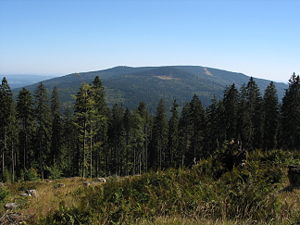
Hochficht
| Hochficht (Smrčina) | ||
|---|---|---|
| height | 1338 m above sea level A. ( 1338 m nm ) | |
| location | Upper Austria , Austria and South Bohemian Region , Czech Republic | |
| Mountains | Bohemian forest | |
| Dominance | 5.7 km → Plöckenstein | |
| Notch height | 320 m ↓ northwest. Studničná | |
| Coordinates | 48 ° 44 '11 " N , 13 ° 55' 16" E | |
|
|
||
| rock | Weinsberger granite | |
The Hochficht (Czech: Smrčina) is a mountain in the Mühlviertel in Upper Austria with a height of 1338 m above sea level. A. Its tip marks the border between Austria and the Czech Republic , there is a rock with a summit cross , a ski lift station and a weather station. The Czech side of the mountain is the core zone of the Šumava / Bohemian Forest National Park . Hochficht, located in the cross-border Bohemian Forest , belongs to the municipality of Klaffer . The communities of Aigen and Ulrichsberg are also not far away and benefit from tourism in the form of high numbers of overnight stays by the local accommodation providers.
Winter sports area
The Hochficht is also a winter sports area , which opens up over the three adjoining mountains Zwieselberg ( 1163 m above sea level ), Reischlberg ( 1281 m above sea level ) and Hochficht , and annually until the end of March or the beginning of April (mostly until Easter ) Has season, season start depending on the weather. There are eight slopes with a total length of around 20 km as well as a ski route which can be reached with two drag lifts and three 4- seater chair lifts ( Hochfichtbahn since 1994, Schwarzenbergbahn since 2001, Zwieselbergbahn since 2004). Since 2017, the 10s promoted gondola Reischl mountain railway in two winter sports sections on Reischl mountain . The longest route is the Stierwiesen run from Hochficht, the second longest is the FIS run, on which European Cup races can also be held. There is also an FIS slalom course on Zwieselberg, on which European Cup races are also held. Most of the slopes (55%) have an easy level of difficulty. The valley station is around 800 m away. Six cross-country trails , three of which can be used free of charge, with a total length of around 165 km complete the offer for winter sports enthusiasts.
"Hochficht Bergbahnen GmbH" is 50% owned by the entrepreneur and ÖSV President Peter Schröcksnadel , who has already made several major investments since his takeover, for example in chairlifts. The Schlägl is also an interest of 50%. In addition to Upper Austrians, the visitors mainly include Mühlviertlers , and in a noteworthy proportion, due to the geographical location, also Czechs and Germans .
The communities of Klaffer and Ulrichsberg each operate a toboggan run on the slopes of the mountain.
Hiking area
While a ski circus is run on the Hochficht in winter, it offers a pleasant rest in summer. All lifts are then out of order, only a small refreshment station is also managed during the summer months. Some hiking trails, including the Nordwaldkammweg from the Dreiländereck to the Waldviertel , lead over the summit; In addition, the viewing points “Stinglfelsen” ( 1260 m above sea level ) and “Schönbergfelsen” ( 1305 m above sea level ) offer further noteworthy stations for hikers.
Web links
Individual evidence
- ↑ VIPs according to viewfinderpanoramas.org ( MS Excel ; 89 kB)
- ↑ Hochfichtbahn. In: Skiresort.de. Retrieved December 28, 2017 .
- ↑ Schwarzenbergbahn. In: Skiresort.de. Retrieved December 28, 2017 .
- ↑ Zwieselbergbahn. In: Skiresort.de. Retrieved December 28, 2017 .
- ↑ Reischlbergbahn 1 + 2. In: Skiresort.de. Retrieved December 28, 2017 .
- ↑ Upper Austrian News: The Czech Republic is working flat out on the Bohemian Hochficht connecting lift . December 10, 2012 ( nachrichten.at [accessed December 28, 2017]).

