Hochstedt (Nordhausen)
|
Hochstedt
City of Nordhausen
Coordinates: 51 ° 31 ′ 16 ″ N , 10 ° 42 ′ 5 ″ E
|
|
|---|---|
| Height : | 216 m |
| Incorporation : | July 1, 1950 |
| Incorporated into: | Talk |
| Postal code : | 99734 |
| Area code : | 036335 |
|
Location of Hochstedt in Nordhausen
|
|
|
In the town
|
|
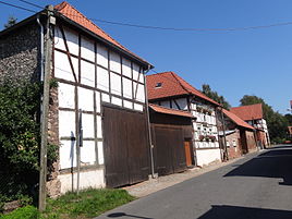
Hochstedt is a district of the city of Nordhausen in Thuringia .
location
Hochstedt is located about six kilometers northwest of the district town of Nordhausen in a rural area.
Waters
The Hochstedt Bach flows through Hochstedt . Its headwaters are northwest of the village. It flows into the helmets at the Flarichsmühle .
history
The great lake hole , a natural monument in a meadow 500 meters south of the village, is part of a chain of karst phenomena in the communal corridor. The roughly circular, water-filled sinkhole has a diameter of about 110 meters. This sight, located south of Hochstedt, probably also had a regional significance as a prehistoric place of worship . Hochstedt was first mentioned on November 4, 1184.
church
Web links
Commons : Hochstedt - Collection of images, videos and audio files
Individual evidence
- ↑ Michael Köhler: Pagan sanctuaries: pre-Christian places of worship and suspected cult sites in Thuringia . Jenzig-Verlag, Jena 2007, ISBN 978-3-910141-85-8 , pp. 76 .
- ^ Wolfgang Kahl : First mention of Thuringian towns and villages. Rockstuhl Verlag, Bad-Langensalza 2010, ISBN 978-3-86777-202-0 , p. 125.


