Hofsgrund
|
Hofsgrund
Municipality of Oberried (Breisgau)
|
|
|---|---|
| Coordinates: 47 ° 54 ′ 3 ″ N , 7 ° 53 ′ 51 ″ E | |
| Height : | 1032 m |
| Residents : | 580 |
| Incorporation : | 1st October 1974 |
| Postal code : | 79254 |
|
Hofsgrund district
|
|
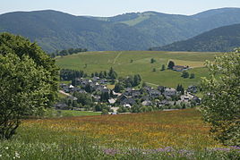
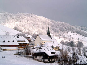
Hofsgrund is a district of Oberried (Breisgau) and has about 580 inhabitants. It is a holiday and winter sports resort and a destination for excursions. It is located at an altitude of 1032 to 1056 m south of the Schauinsland summit .
history
Hofsgrund was first mentioned in a document in the 11th century. At that time the area belonged to the Swiss monastery of St. Gallen . A little later the Zähringer occupied the area and passed it on to regional nobles as a fief . In 1296 the "Dingrodel", a local constitution, was sealed by the monastery heads of the St. Märgen and St. Wilhelm monasteries as well as by local nobles.
Until the beginning of the 16th century Hofsgrund was called Rütti , an Alemannic name for "the cleared land". The name Hofsgrund is used for the first time on August 15, 1517 in the mining regulations of Emperor Maximilian . In 1566 ore and miners from Hofsgrund are mentioned. You were employed in mining on the Schauinsland - at that time known as the “ore box”. Other residents were day laborers or dependent farmers.
In 1806 the place came to Baden and there to the Oberamt Freiburg . On October 1, 1974, the place was incorporated into Oberried.
Ski Area
The Hofsgrund ski area is mainly used by Freiburg residents. It has four tow lifts and two floodlights . It can also be reached with the Schauinsland cable car .
Schniederlihof
Above Hofsgrund stands at 1,080 m above sea level. NHN the Schniederlihof , built in 1593 , an old typical Black Forest farm of the Schauinslandhaus type , which as a museum documents the rural life of previous centuries in the southern Black Forest. Schnieder is the Alemannic form for tailors, Schniederli the diminutive. The farm can be reached on foot in around 30 minutes from the Laurentiuskirche Hofsgrund.
Personalities
- Eberhard Feik (1943–1994), actor and partner of Götz George in the Tatort series Schimanski , lived in Hofsgrund during the last years of his life and is buried there.
- Thomas Spitzer (born September 29, 1988 in Freiburg im Breisgau ) is a German author , comedian and promoter.
- Roman Rees (born March 1, 1993 in Freiburg im Breisgau ) is a German biathlete .
Individual evidence
- ^ Federal Statistical Office (ed.): Historical municipality directory for the Federal Republic of Germany. Name, border and key number changes in municipalities, counties and administrative districts from May 27, 1970 to December 31, 1982 . W. Kohlhammer, Stuttgart / Mainz 1983, ISBN 3-17-003263-1 , p. 509 .


