Hohe Tanne (pass)
| Tall fir | |||
|---|---|---|---|
|
Hotel-Restaurant Hohe Tanne |
|||
| Compass direction | north | south | |
| Pass height | 701 m above sea level NHN | ||
| state | Thuringia | ||
| Valley locations | Miter | Oils | |
| expansion | L 1047 from Gehren to Oelze | ||
| Mountains | Thuringian Forest , Thuringian Slate Mountains | ||
| Map (Thuringia) | |||
|
|
|||
| Coordinates | 50 ° 35 '39 " N , 10 ° 59' 5" E | ||
The Hohe Tanne ( 701 m above sea level ) is a pass and part of the town of Großbreitenbach in the Ilm district in Thuringia .
geography
Geographically, the Hohe Tanne forms part of the natural border between the Thuringian Forest and the Thuringian Slate Mountains or the pass crossing from the Thuringian Forest to the Long Mountain in the Thuringian Slate Mountains. It is also the watershed of the Ilm and Saale rivers .
Infrastructure
gastronomy
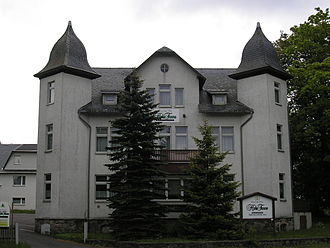
- Hotel-Restaurant Hohe Tanne
traffic
- Former railway line
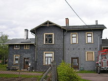
The Neustadt-Gillersdorf station on the Ilmenau – Großbreitenbach railway line has been located here since 1882 and served as a rail connection for the communities of Gillersdorf and Neustadt am Rennsteig. The station was shut down together with the railway line in 1992. The route of the Ilm-Rennsteig cycle path , which was completed in August 2013, now runs along the embankment of the railway line .
- Street
At the Hohe Tanne, the state road L1143 coming from Neustadt am Rennsteig meets the state road L1047, which when coming from Gehren crosses the pass and continues to Katzhütte . Furthermore, the district road K54 branches off from the L1047 in the direction of Gillersdorf. The state road L1143 and the district road K54 are part of the Thuringian Forest Nature Park Route . The Hohe Tanne is well connected to public transport and is served by the bus routes 303 and 304 of the IOV Omnibusverkehr Ilmenau , which operates two bus stops here.
Nature trail
The Pilzsteig nature trail , which runs from Neustadt am Rennsteig to Gehren, leads over the Hohe Tanne .
Industry
In 2011 the groundbreaking ceremony for the reconstruction of the industrial and commercial area took place on the site of the former Hohe Tanne glassworks , which was demolished as part of the necessary development work. The development work was completed in 2013.
Individual evidence
- ↑ Map services of the Federal Agency for Nature Conservation ( information )
- ↑ Tall fir. In: quäldich.de. Retrieved January 28, 2014 .
- ↑ Mushroom trail: The mushroom trail. Retrieved February 7, 2014 .
- ^ "Hohe Tanne" industrial park: Groundbreaking for the demolition. Retrieved December 9, 2013 .


