Hohentanner forest
| Hohentanner forest | ||
|---|---|---|
| Highest peak | nameless mountain ( 960 m above sea level ) | |
| location | Adelegg , Oberallgäu District , Bavaria ( Germany ) | |
|
|
||
| Coordinates | 47 ° 46 ' N , 10 ° 9' E | |
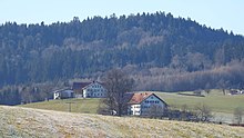
The Hohentanner forest is one to about 960 m above sea level. NHN high part of the Adelegg mountain landscape and is located within the West Allgäu in the Oberallgäu district ( Bavaria ) in southern Germany .
The term Hohentanner Wald stands for the so-called forest area of the Adelegg as well as for one of six district names of Altusried, whereby the forest area extends beyond the district boundary. The Hohentanner Wald district within the Altusried community was a community-free area until December 31, 1973 .
geography
location
The predominantly heavily forested Hohentanner Forest, which extends exclusively in the southwestern municipality of Altusried , is north-northeast of the actual Adelegg mountain range and west-northwest of Wiggensbach . Beyond the Kürnach , to the south of the Hohentanner Forest and southeast in the municipal area of Wiggensbach on both sides of the stream, the Kürnacher Forest joins.
mountains
The mountains and foothills of the Hohentanner Forest include - sorted by height in meters (m) above sea level (NHN):
- nameless mountain (approx. 960 m ), 1.1 km northeast of Walkenberg and 2.2 km west-southwest of Kimratshofen - Walzlings
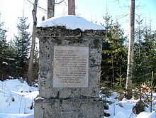
- Walkenberg ( 951.6 m ), 800 m east-southeast of Altusried - Walkenberg ; with an old hill
- Langenberg ( 870.9 m ), 2 km southwest of Kimratshofen
- nameless mountain (approx. 830 m ), 1.3 km west-southwest of Kimratshofen; with Hohentann castle ruins
Waters
On the southern edge of the Hohentanner Forest, the small Kürnach , which is an eastern tributary of the Eschach , runs along the border to the Kürnacher Forest , a section of which in turn forms the boundary to Adelegg . In addition, many small tributaries from Eschach and Kürnach as well as the Iller tributary Lautrach arise in or on the edge of the Hohentanner Forest . The Iller tributary Kollerbach flows past east-southeast .
Protected area
Large parts of the Hohentanner forest belong to the northern area of the fauna-flora-habitat area Kürnacher Wald (FFH no. 8227-373).
Worth seeing
In addition to its beautiful forest landscape, the sights of the Hohentanner Forest include the remains of the Hohentann castle ruins southwest of Kimratshofen (a western part of Altusried ).
Individual evidence
- ↑ a b c Map services of the Federal Agency for Nature Conservation ( information )
- ↑ Information about Altusried with a map of the districts (including Hohentanner Forest) on altusried.de ( memento of the original from February 25, 2010 in the Internet Archive ) Info: The archive link was automatically inserted and not yet checked. Please check the original and archive link according to the instructions and then remove this notice.


