Hohenwart (Wölzer Tauern)
| Hohenwart | ||
|---|---|---|
|
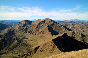
The Hohenwart with Fischsee from the southeast |
||
| height | 2363 m above sea level A. | |
| location | Styria , Austria | |
| Mountains | Rottenmanner and Wölzer Tauern | |
| Dominance | 3.5 km → Hochweberspitze | |
| Notch height | 375 m ↓ Glattjoch | |
| Coordinates | 47 ° 19 '46 " N , 14 ° 14' 10" E | |
|
|
||
| rock | Mica schist , marble , amphibolite | |
The Hohenwart is 2363 m above sea level. A. high mountain on the main Alpine ridge of the Wölzer Tauern in Upper Styria .
Location and landscape
The Hohenwart is located in the main ridge of the Niedere Tauern , between Pölstal and Wölzertal , two side valleys of the Murtal , in the south, and the Donnersbachtal , a side valley of the Ennstal , in the north.
The ridge that separates the Pusterwaldtal , a side valley from Pöls , and the Wölzer Schöttlgraben begins at Hohenwart . The actual watershed Drau - Enns (main Alpine ridge), which stretches northwards for a short time up to the wind gaps , is located on the western secondary peak, the Eiskarspitz ( 2350 m ). In this direction is located after the Glattschartl (approximately 2070 m ) of the Schönfeldspitze ( 2202 m ). The Tauern main ridge descends southwest to the Glattjoch ( 1988 m ), followed by the Hochweberspitze ( 2375 m ). In the side ridge to the southeast, after the Pölseckjoch ( 2011 m ), the Großhansl ( 2315 m ) rises . This ridge leads to the Schießeck and Schönberg ( Tauernwindpark ).
In the south are the Wildsee and below the Fischsee , two cirque lakes from which the Schöttlbach arises. The Pusterwaldbach (also called [Vorderer] Pölsenbach here) rises in the Eiskar to the north . In the west there is a feeder from the Beireut-Glatt high valley to the Beireutbach , which goes from the Glattjoch to the Donnersbach and the Enns.
Climbs
The mountain is easily accessible from all sides. The normal route leads over the Pölseckjoch over the southeast ridge to the summit. Valley locations for this ascent are Pusterwald or Oberwölz . The summit can also be reached a little more demanding from Donnersbachwald via the Glattjoch via a marked path.
literature
- Peter Holl: Alpine Club Guide Niedere Tauern , Bergverlag Rudolf Rother , Munich 1983. ISBN 3-7633-1231-5

