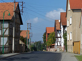
Horschlitt
|
Horschlitt
City of Werra-Suhl-Tal
Coordinates: 50 ° 55 ′ 19 ″ N , 10 ° 5 ′ 44 ″ E
|
|
|---|---|
| Height : | 229 m above sea level NN |
| Area : | 3.61 km² |
| Incorporation : | March 18, 1994 |
| Incorporated into: | Berka / Werra |
| Postal code : | 99837 |
| Area code : | 036922 |
|
Location of Horschlitt in Werra-Suhl-Tal
|
|
|
In the local situation
|
|
Horschlitt is a district of the town of Werra-Suhl-Tal in the Wartburg district in Thuringia .
geography
Horschlitt is located 3 km south-east of the Berka / Werra administrative headquarters in the center of the Horschlitter Mulde. The geographic height of the place is 229 m above sea level. NN . The "Hauptgraben", a left tributary of the Suhl, drains the community corridor.
history
The lords of Mihla were in 1260 feudal lords of the village of Horschlitt in the office of Hausbreitenbach . In the 16th century the region around Herda and Horschlitt was a center of the Anabaptist movement . In 1879, C. Kronfeld published regional and statistical information about the place: Horschlitt is a village with 45 houses and 252 inhabitants. The total area of the village is 325.30 ha, of which farms and gardens account for 5.28 ha, meadows 35.62 ha, arable land 170.98 ha, forest 35.6 ha, ponds, streams and rivers 0.1 ha, paths , Drifts and fruit trees 77.79 ha. The livestock consists of 8 horses, 157 cattle, 220 sheep, 72 pigs, 19 goats and 66 colonies of bees.
On July 1, 1974, Auenheim-Rienau was incorporated into the Horschlitt community. The Thuringian Ordinance of February 16, 1994 dissolved the communities of Fernbreitenbach, Gospenroda, Herda, Horschlitt and Vitzeroda and incorporated them into the city of Berka / Werra with effect from March 18, 1994. This went into the city on January 1, 2019 Werra-Suhl-Tal. Together with Auenheim-Rienau, Horschlitt has since formed the Horschlitt district of the city of Werra-Suhl-Tal.
societies
Five radio amateurs from Horschlitt form the core of the German national team and operate Morse radio stations as an association. Since 1996, 9 world championship titles have been won in the International Amateur Radio Union (IARU) and defended against 30 national teams and thousands of radio amateurs. The Horschlitter amateurs have specialized in telegraphy in the 160 meter band (medium wave).
Individual evidence
- ↑ Official topographic maps of Thuringia 1: 10,000. Wartburgkreis, district of Gotha, district-free city of Eisenach . In: Thuringian Land Survey Office (Hrsg.): CD-ROM series Top10 . CD 2. Erfurt 1999.
- ^ Constantin Kronfeld: Regional Studies of the Grand Duchy of Saxony-Weimar-Eisenach. Part 2: Topography of the Land. Böhlau, Weimar 1879, p. 364 .
- ^ Thuringian ordinance on the dissolution of the communities Fernbreitenbach, Gospenroda, Herda, Horschlitt and Vitzeroda and their incorporation into the town of Berka / Werra of February 16, 1994 (GVBl p. 288).
- ↑ Thuringian Law and Ordinance Gazette No. 14/2018 p. 795 ff. , Accessed on January 2, 2019
- ^ Main statute of the city of Werra-Suhl-Tal from January 19, 2019
- ↑ Linda Eder: World Cup heroes from Horschlitt. In: Thüringer Allgemeine / Eisenacher Allgemeine, local page Eisenach, from July 15, 2008

