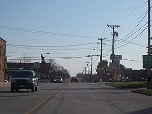
Howards Grove
| Howards Grove | ||
|---|---|---|
 In the center of Howard's Grove |
||
| Location in Wisconsin | ||
|
|
||
| Basic data | ||
| State : | United States | |
| State : | Wisconsin | |
| County : | Sheboygan County | |
| Coordinates : | 43 ° 50 ′ N , 87 ° 49 ′ W | |
| Time zone : | Central ( UTC − 6 / −5 ) | |
| Residents : | 3,188 (as of 2010) | |
| Population density : | 526.1 inhabitants per km 2 | |
| Area : | 6.06 km 2 (approx. 2 mi 2 ) | |
| Height : | 217 m | |
| Postal code : | 53083 | |
| Area code : | +1 920 | |
| FIPS : | 55-36025 | |
| GNIS ID : | 1566769 | |
| Website : | howardsgrove.org | |
| Mayor : | James Scheiber (President) | |
Howards Grove is a municipality (with the status " Village ") in Sheboygan County in the US -amerikanischen State Wisconsin . In 2010 , Howards Grove had 3,188 residents.
geography
Howards Grove is located in southeast Wisconsin on both sides of the Pigeon River , which flows into Lake Michigan about 10 km southeast .
The geographical coordinates of Howards Grove are 43 ° 50'02 "north latitude and 87 ° 49'12" west longitude. The municipality extends over an area of 6.06 km² and is surrounded by the Town of Herman , without belonging to it.
Neighboring towns to Howards Grove are Meeme (10 km north), Cleveland (14.6 km northeast), Moselle (7.8 km southeast), Sheboygan (13.5 km southeast), Kohler (12.1 km south-southeast), Sheboygan Falls (12.5 km south), Plymouth (14.3 km southwest), Elkhart Lake (16 km west), Kiel (20.1 km west-northwest), and St. Nazianz (15.6 km north-northwest).
The nearest major cities are Green Bay (91 km north), Appleton (81.5 km northwest), Wisconsin's capital Madison (182 km southwest), Wisconsin's largest city Milwaukee (98.3 km south) and Chicago , Illinois (150 miles in the same direction).
traffic
The Interstate Highway 43 , which forms the shortest connection from Milwaukee to Green Bay, runs in a north-south direction at about 3 km distance along the eastern municipal boundary of Howard Grove. Wisconsin State Highways 32 and 42 meet in the center of town . All other roads are subordinate country roads, some unpaved roads and inner-city connecting roads.
With the Sheboygan County Memorial Airport there is a small airfield 11.6 km south-southwest. The nearest commercial airports are Austin Straubel International Airport in Green Bay (59 miles north) and Milwaukee Mitchell International Airport in Milwaukee (108 miles south).
population
Howards Grove had 3,188 people in 1,245 households according to the 2010 census . The population density was 526 inhabitants per square kilometer. Statistically, 2.56 people lived in each of the 1245 households.
The racial the population was composed of 98.3 percent white, 0.4 percent African American, 0.1 percent Native American, 0.6 percent Asian and 0.2 percent from other ethnic groups; 0.5 percent were descended from two or more races. Hispanic or Latino of any race was 0.9 percent of the population.
25.3 percent of the population were under 18 years old, 62.7 percent were between 18 and 64 and 12.0 percent were 65 years or older. 49.5 percent of the population were female.
The average annual income for a household was 70,349 USD . The per capita income was $ 31,443. 1.5 percent of the population lived below the poverty line.
Individual evidence
- ^ Village of Howards Grove - James Scheiber. Retrieved August 27, 2014
- ↑ a b American Fact Finder. Retrieved August 27, 2014
- ↑ Distance information according to Google Maps. Accessed on August 27, 2014
- ↑ AirNav.com - Sheboygan County Memorial Airport Accessed on August 27, 2014
