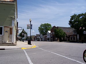
Kiel (Wisconsin)
| Kiel | ||
|---|---|---|
 Downtown of Kiel |
||
| Location in Wisconsin | ||
|
|
||
| Basic data | ||
| State : | United States | |
| State : | Wisconsin | |
| Counties : |
Manitowoc County Calumet County |
|
| Coordinates : | 43 ° 55 ′ N , 88 ° 2 ′ W | |
| Time zone : | Central ( UTC − 6 / −5 ) | |
| Residents : | 3,738 (as of 2010) | |
| Population density : | 570.7 inhabitants per km 2 | |
| Area : | 6.92 km 2 (approx. 3 mi 2 ) of which 6.55 km 2 (approx. 3 mi 2 ) is land |
|
| Height : | 280 m | |
| Postal code : | 53042 | |
| Area code : | +1 920 | |
| FIPS : | 55-39525 | |
| GNIS ID : | 1567461 | |
| Website : | ci.kiel.wi.us | |
| Mayor : | Mike Steinhardt | |
 Town hall of Kiel |
||
Kiel is a small town (with the status " City ") in Manitowoc County and to a lesser extent in Calumet County in the US -amerikanischen State Wisconsin . In 2010 Kiel had 3738 inhabitants.
geography
Kiel is located in eastern Wisconsin, on both sides of the Sheboygan River, which flows into Lake Michigan . Lake Michigan is around 25 km to the east, and Lake Winnebago is 25 km to the west.
The geographic coordinates of Kiel are 43 ° 54'53 "north latitude and 88 ° 01'55" west longitude. The urban area extends over an area of 6.92 km², which is spread over 6.55 km² of land and 0.37 km² of water.
Neighboring towns of Kiel are St. Nazianz (19.6 km northeast), Rockville (4 km east), Howards Grove (20.1 km southeast), Elkhart Lake (10.5 km south-southeast), St. Cloud (13.4 km southwest) and New Holstein (6.2 km northwest).
The closest major cities are Sheboygan (30 km southeast), and Manitowoc (40 km northeast), both on Lake Michigan.
The closest major cities are Green Bay (75.9 km north), Wisconsin's largest city Milwaukee (105 km south), Chicago , Illinois (250 km in the same direction), Wisconsin's capital Madison (164 km southwest), and Appleton (61.2 km km northwest).
history
Charley Lindemann was the first white settler in the immediate area. The Indian tribes residing in the area at that time were the Potawatomi and the Menominee . In 1852, Lindemann founded a settlement that his wife named after her home town of Kiel in Schleswig-Holstein . Two years later, Colonel Henry F. Belitz, later called "Father of Kiel", built a hotel and a mill on the north bank of the Sheboygan River. Soon a country road ran through the young town between Green Bay and Milwaukee. For this purpose a bridge was built over the Sheboygan River in 1858, and from then on Kiel had good transport links to Sheboygan, which promoted further development. In the late 19th and early 20th centuries, Kiel developed into an industrial location with trades that made bricks , wooden shoes , machines and furniture . Kiel was once known as the "wooden shoe capital" of Wisconsin as the only wooden shoe factory in the state was located here.
traffic
Wisconsin State Highways 32 , 57 and 67 meet in the center of Kiel . All other roads are subordinate country roads, some unpaved roads and inner-city connecting roads.
Two freight railroad lines, the Canadian National Railway (CN) and the Wisconsin and Southern Railroad (WSOR), meet in Kiel .
The New Holstein Municipal Airport is located 8.8 km northwest of a small airfield. The nearest commercial airports are Outagamie County Regional Airport at Appleton (70.6 km northwest), Austin Straubel International Airport in Green Bay (84.4 km north) and Milwaukee Mitchell International Airport in Milwaukee (115 km south).
population
According to the 2010 census , there were 3738 people in 1565 households in Kiel. The population density was 602.9 inhabitants per square kilometer. Statistically, there were 2.39 people in each of the 1565 households.
The racial the population was composed of 96.9 percent white , 0.4 percent African American , 0.6 percent Native American , 0.6 percent Asian and 0.7 percent from other ethnic groups; 0.8 percent were descended from two or more races. Hispanic or Latino of any race was 2.0 percent of the population .
26.5 percent of the population were under 18 years old, 57.8 percent were between 18 and 64 and 15.7 percent were 65 years or older. 52.0 percent of the population were female.
The average annual income for a household was 53,786 USD . The per capita income was $ 26,253. 4.5 percent of the population lived below the poverty line.
Known residents
- Karl A. Schleunes (* 1937) - historian - born in Kiel
Individual evidence
- ↑ City Council Information ( Memento of the original from April 7, 2014 in the Internet Archive ) Info: The archive link was automatically inserted and not yet checked. Please check the original and archive link according to the instructions and then remove this notice. Retrieved February 2, 2014
- ↑ a b American Fact Finder. Retrieved April 2, 2014
- ↑ Distance information according to Google Maps. Accessed April 2, 2014
- ^ Wisconsin Department of Transportation, Railroad Map (PDF; 379 kB) Retrieved April 2, 2014
- ↑ AirNav.com - New Holstein Municipal Airport Retrieved on April 2, 2014


