Huron River (Ohio)
| Huron River | ||
|
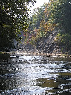
Autumn on the West Branch of the Huron River near Milan |
||
| Data | ||
| Water code | US : 1076100 | |
| location | northern state of Ohio (USA) | |
| River system | Saint Lawrence River | |
| Drain over | Niagara River → Saint Lawrence River → Atlantic Ocean | |
| Confluence of | East Branch and West Branch Huron River 2 miles west of the town of Milan in Huron County, OH 41 ° 17 ′ 23 ″ N , 82 ° 38 ′ 16 ″ W |
|
| Source height | 181 m | |
| muzzle | Lake Erie near Huron in Erie County, OH Coordinates: 41 ° 23 '53 " N , 82 ° 32' 57" W 41 ° 23 '53 " N , 82 ° 32' 57" W |
|
| Mouth height | 175 m | |
| Height difference | 6 m | |
| Bottom slope | 0.06 ‰ | |
| length | 96 km | |
| Catchment area | 1044 km² | |
The Huron River is a 96 km long tributary of Lake Erie on its south bank in the northern US state of Ohio .
The Huron River drains 1,044 km² of predominantly agricultural land that lies in the catchment area of Lake Erie. It arises from the confluence of the West Branch Huron River and East Branch Huron River near the town of Milan in Huron County , flows meandering in a generally northeastern direction and flows into Lake Erie at Huron in Erie County .
The left source river is the West Branch Huron River , which rises about 7 km east of Shiloh in Richland County ( 40 ° 58 ′ 19 ″ N , 82 ° 31 ′ 37 ″ W ), then first in a westerly and then in a northerly direction to the confluence flows with the East Branch near Milan.
Right source river is the East Branch Huron River , which rises 6 km north of the town of Greenwich in Huron County ( 41 ° 4 ′ 28 ″ N , 82 ° 32 ′ 9 ″ W ) and then generally in a north-northwest direction to the confluence with the East Branch flows at Milan.
The catchment area of the Huron River is mainly used for agriculture, of which 74% is arable land, 15% forest and 3–11% is cultivated or used for other purposes. The East Branch serves as a water reservoir for the city of Norwalk , while the village of Monroeville uses the water from the West Branch as a reservoir.
Web links
- Huron River in the United States Geological Survey's Geographic Names Information System
- West Branch Huron River in the United States Geological Survey's Geographic Names Information System
- East Branch Huron River in the United States Geological Survey's Geographic Names Information System
Individual evidence
- ↑ a b Google Earth altitude for GNIS coordinates, accessed in July 2010.
- ↑ a b c d Huron River Watershed ( Memento of the original from February 9, 2012 in the Internet Archive ) Info: The archive link was automatically inserted and not yet checked. Please check the original and archive link according to the instructions and then remove this notice. , accessed July 23, 2010
- ^ GNIS West Branch Huron River , accessed July 23, 2010
- ^ GNIS East Branch Huron River , accessed July 23, 2010
