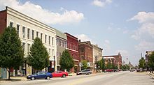
Norwalk (Ohio)
| Norwalk | |
|---|---|
|
Location in Ohio
|
|
| Basic data | |
| Foundation : | 1817 |
| State : | United States |
| State : | Ohio |
| County : | Huron County |
| Coordinates : | 41 ° 15 ′ N , 82 ° 37 ′ W |
| Time zone : | Eastern ( UTC − 5 / −4 ) |
| Residents : | 16,238 (as of: 2000) |
| Population density : | 751.8 inhabitants per km 2 |
| Area : | 22.2 km 2 (approx. 9 mi 2 ) of which 21.6 km 2 (approx. 8 mi 2 ) is land |
| Height : | 219 m |
| Postal code : | 44857 |
| Area code : | +1 419 |
| FIPS : | 39-57302 |
| GNIS ID : | 1044003 |
| Website : | www.norwalkoh.com |
| Mayor : | Sue Lesch |
Norwalk is a small American town in the north of the state of Ohio . It is about halfway between Cleveland and Toledo , and Lake Erie is 20 minutes by car. Norwalk has around 16,000 residents. The official coat of arms is the maple leaf.
history

Norwalk, Ohio is after the same-named town in Connecticut called, which was up to six homes destroyed by the British on 11 July 1779th As compensation, land (so-called "Firelands") in northern Ohio was given in October 1800 and the land was taken by citizens from settlements in Connecticut. At first, this settlement was slow until the middle of the 19th century. In 1881 the minimum number of citizens was reached and therefore Norwalk was granted city rights.
Specialty (medicine)
The city gained fame in 1968 with a massive outbreak of infectious gastroenteritis with a pathogen that was still unknown at the time. This could be characterized and identified in 1972. It was named "Norwalk virus" after the place of initial isolation and classified as a prototype of an independent group within the family of Caliciviridae ; In 2002 the genus was renamed Norovirus .
Famous daughters and sons of the parish
- Paul Brown (1908-1991), American football coach
- Bud Spangler (1938–2014), jazz drummer and music producer
