Hutě (Černýšovice)
| Hutě | ||||
|---|---|---|---|---|
|
||||
| Basic data | ||||
| State : |
|
|||
| Region : | Jihočeský kraj | |||
| District : | Tábor | |||
| Municipality : | Černýšovice | |||
| Geographic location : | 49 ° 19 ′ N , 14 ° 30 ′ E | |||
| Height: | 390 m nm | |||
| Residents : | 32 (March 1, 2001) | |||
| Postal code : | 391 65 | |||
| License plate : | C. | |||
| traffic | ||||
| Street: | Bechyně - Černýšovice | |||
| Next international airport : | České Budějovice Airport | |||
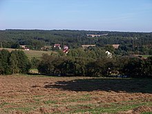
Hutě (German Eisenhammer ) is a district of the municipality Černýšovice in the Czech Republic . It is located three kilometers northeast of Bechyně in South Bohemia and belongs to the Okres Tábor .
geography
Hutě is located in the Lainsitz Valley in the Bechin Hills ( Bechyňská pahorkatina ). The village is located on the left bank of the river in a valley above the confluence of the Sudoměřický potok. In the northeast rises the Kameník (420 m), behind it lies the Panský rybník pond. The Bechyně military airfield extends to the south.
Neighboring towns are Větrov, Dvorce, Dobronice u Bechyně and Cernysovice in the north, Všechlapy in the Northeast, Bechyňská Smoleč the east, Bežerovice the southeast, Jamník, Březnice and Hodonice in the south, Lišky, Chrobkov and Bechyně in the southwest, Radětice , Na Prádle and Senožaty in West and Haškovcova Lhota in the north-west.
history
In 1514, the owner of the estate Bechin Ladislav von Sternberg, with the permission of King Vladislav II Jagiello, began mining several hematite deposits near Sudoměřice . To process the ore, he had an iron hammer put on at the Lainsitz . After it became clear that the individual hematite deposits did not form a coherent deposit and were soon dismantled, ore was brought in from Kamenice nad Lipou for the operation of the iron hammer . In 1530 the Lords of Schwanberg bought Bechyně, in 1569 Heinrich von Schwanberg sold the rule to Peter Wok von Rosenberg . He sold the rule to the Lords of Sternberg in 1596. At the beginning of the Thirty Years' War, the imperial troops invaded the area murdering, burning and looting. The iron hammer went out in the 17th century. In 1715, the Counts of Paar gained power through marriage. In 1840 the village Eisenhammer or Eisenhütte / Huttie consisted of 32 houses with 217 inhabitants. At Eisenhammer there was an overpass over the Luschnitz . The parish and school location was Sudoměřitz . Until the middle of the 19th century, Eisenhammer always remained subservient to Bechin .
After the abolition of patrimonial formed Hutě / Eisenhammer 1850 a district of the municipality Černošovice / Černoschowitz in the district administration Milevsko / Mulhouse and the Judicial District Bechyně / Bechin. After the dissolution of the Okres Milevsko, the village became part of the Okres Týn nad Vltavou on February 21, 1949. On March 27, 1960 Hutě, Černýšovice, Bežerovice, Smoleč and Sudoměřice to form the municipality Sudoměřice u Bechyně . After the Okres Týn nad Vltavou was abolished, the municipality was assigned to the Okres Tábor in late 1960 . On July 22, 1988, a new Lainsitz bridge was built. After a referendum, Černýšovice and Hutě broke away from Sudoměřice on November 24, 1990 and formed the municipality of Černýšovice. In 1991 there were 30 people living in Hutě, the 2001 census counted 40 houses and 32 inhabitants.
Attractions
- chapel
- Natural monument Černýšovické jalovce, east of the village, the population of 300 old juniper trees in the aisle of a high-voltage line represents the largest juniper occurrence in southern Bohemia.
- Listed linden tree on the slope north above the village
- Fortress Chrobkov, southwest of the Lainsitz over a bend in the river
Individual evidence
- ↑ Johann Gottfried Sommer : The Kingdom of Bohemia. Represented statistically and topographically. Volume 10: Tabor Circle. Ehrlich, Prague 1842, p. 34.


