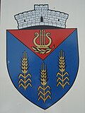
Iertof
|
Iertof Heuersdorf Hévér |
||||
|
||||
| Basic data | ||||
|---|---|---|---|---|
| State : |
|
|||
| Historical region : | Banat | |||
| Circle : | Caraș-Severin | |||
| Municipality : | Vrani | |||
| Coordinates : | 45 ° 1 ' N , 21 ° 31' E | |||
| Time zone : | EET ( UTC +2) | |||
| Residents : | 142 (2002) | |||
| Postal code : | 327432 | |||
| Telephone code : | (+40) 02 55 | |||
| License plate : | CS | |||
| Structure and administration | ||||
| Community type : | Village | |||
Iertof (German: Heuersdorf , Hungarian: Hévér ) is a village in the Caraș-Severin district , Banat , Romania . The village of Iertof belongs to the municipality of Vrani .
Geographical location
Iertof is located in the west of the Caraș-Severin County, near the border with the Timiș County .
Neighboring places
| Ciortea | Vrani | Mercina |
| Milcoveni |

|
Răcășdia |
| Berliște | Rusova Noua | Vrăniuț |
history
In the course of time the village had different names: 1723 Herdorf , 1761 Haiesdorf , 1779 Heinersdorf , 1888 Heuersdorf , 1913 Hévér , 1924 Iertof .
On the Josephine land survey of 1717, the place Heuerdorf is registered with 48 houses. After the Peace of Passarowitz (1718) the village was part of the Habsburg crown domain Temescher Banat .
The Treaty of Trianon on June 4, 1920 resulted in the triple division of the Banat, whereby Iertof fell to the Kingdom of Romania .
Population development
| census | Ethnicity | |||||||
|---|---|---|---|---|---|---|---|---|
| year | Residents | Romanians | Hungary | German | Other | |||
| 1880 | 692 | 685 | - | 7th | - | |||
| 1910 | 629 | 621 | - | - | 8th | |||
| 1930 | 594 | 583 | - | 1 | 10 | |||
| 1977 | 244 | 229 | - | 1 | 14th | |||
| 2002 | 142 | 109 | - | - | 33 | |||
Web links
- banaterra.eu , Transylvanian towns


