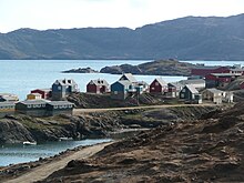
Irmingersee
Coordinates: 62 ° N , 35 ° W
The Irmingersee is a marine area in the North Atlantic . The northern border is on the Greenland-Iceland threshold in the Denmark Strait between Greenland and Iceland , which connects it with the Greenland Sea . To the southwest it extends to Cape Farvel , the southern tip of Greenland, and at this point borders on the Labrador Sea . To the south of it lies the open North Atlantic. It is 480 km long and 290 km wide at the narrowest point and covers an area of around 800,000 km². The average water depth is given as around 2800 meters. The sea floor is largely occupied by the Irminger Basin , an extension of the up to 4600 m deep Labrador Basin , which is bordered to the east by the Reykjanes Ridge . The delimitation is purely oceanographic, so it does not mark any official borders or territories. The Irmingersee is traditionally one of the main fishing grounds for redfish .
The sea area got its name from the Danish Vice Admiral Carl Ludvig Christian Irminger (1802–1888), after whom the Irmingerstrom was named.
Individual evidence
- ↑ Yu.I. Bakay: PARASITES AND PIGMENTED PATCHES AS INDICATORS OF INTRASPECIFIC STRUCTURE OF SEBASTES MENTELLA IN THE IRMINGER SEA (Original stated : above 300 thou. Square miles )
- ^ Commander Axel Fiedler: "Om Irminger Havets og Irmingerstrømmens navn". Søværnsorientering No. 1 , March 2003 PDF ( Memento of September 27, 2007 in the Internet Archive ).
Web links
- Irminger Sea . Woods Hole Oceanographic Institution . Retrieved on November 17, 2009. with a map of the Irmingersee
- Irminger Sea . Royal Netherlands Institute for Sea Research (archived). Archived from the original on December 22, 2011. Retrieved November 17, 2009.
- Оперативный мониторинг ТПО: Норвежское море, Море Ирмингера, Марокко, Мавритания . Атлантический научно-исследовательский институт рыбного хозяйства и океанографии. Retrieved November 17, 2009.


