Jítrava
| Jítrava | ||||
|---|---|---|---|---|
|
||||
| Basic data | ||||
| State : |
|
|||
| Region : | Liberecký kraj | |||
| District : | Liberec | |||
| Municipality : | Rynoltice | |||
| Area : | 863.1628 ha | |||
| Geographic location : | 50 ° 48 ' N , 14 ° 51' E | |||
| Height: | 391 m nm | |||
| Residents : | 137 (March 1, 2001) | |||
| Postal code : | 463 53 | |||
| License plate : | L. | |||
Jítrava (German German Pankraz ) is a district of the municipality Rynoltice in Okres Liberec in the Czech Republic.
geography
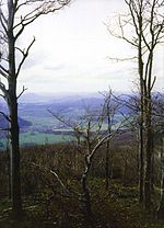
Jítrava is located 15 km northwest of the center of Liberec at an altitude of 391 m on the western slope of the Jeschken Mountains . The E 442 runs right past the village and crosses the mountains between Bílý Kostel nad Nisou and Jablonné v Podještědí over the pass on the Freudenhöhe (Jítravské sedlo). The Freudenhöhe (419 m) divides the Lusatian Mountains from the Jeschkengebirge, here there used to be a small settlement with 3 houses, of which the Lamersche Gasthaus, which burned down around 1920, was once a well-known excursion restaurant. When the road was expanded in the 1980s, the settlement was demolished.
The European long-distance hiking trail E3 leads north-east past the village between Hochwald and Jeschken .
Jítrava is surrounded in the north and east by the 545 m high Trögelsberg ( Vysoká ), the 651 m high Sponge Mountain ( Jítravský vrch ) and the 790 m high Great Limestone Mountain ( Velký Vápenný ), over whose summit the long-distance hiking trail E3 leads directly. In addition to the Fellerkofel (Havran) on the Schwammberg , the striking Bílé Kameny and Sloní Kameny ( elephant stones ) on the Trögelsberg opposite are primarily a destination for hikers. The ruins of Roimund Castle stand in the woods of the Jeschkengebirge near the village .
history
The village, which stretches along the Panenský potok ( Jungfernbach ), which rises from the Great Kalkberg , was originally called Dittersdorf. The first written mention of the Ditherivilla comes from the year 1370. In the 15th century the place was burned down by the Hussites and remained desolate . When a place was later re-established in the same place, it was named Pankraz after St. Pankratius . In 1710, the St. Pankratius Church was built in the center of the village. On April 8, 1868, lightning struck the church, which then burned down, but was soon rebuilt.
In addition to the sandstone quarries on Trögelsberg, which were closed in 1878 , the slate and limestone quarries belonging to the city of Zittau on the Großer and Kleiner Kalkberg were the most important employers for the residents of Deutsch-Pankratz. In 1939 615 inhabitants lived here.
Today the place, which was incorporated into Rynoltice after the Second World War, lives mainly from tourism. Today there is a survival camp in the village . In 1991 Jítrava had 150 inhabitants. In 2001 the village consisted of 82 houses in which 137 people lived.
Sons and daughters
- Christian Keimann (1607–1662), educator and poet
- François Linke (1855–1946), cabinet maker


