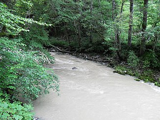
Javro
|
Javro upper run name: Rio de Grattavache |
||
|
The Javro at Cerniat |
||
| Data | ||
| Water code | CH : 1589 | |
| location | Switzerland | |
| River system | Rhine | |
| Drain over | Jaunbach → Saane → Aare → Rhine → North Sea | |
| source | wherein Alp La Balisa 46 ° 39 '14 " N , 7 ° 14' 36" O |
|
| Source height | approx. 1408 m above sea level M. | |
| muzzle | in the Lac de Montsalvens near Crésuz Coordinates: 46 ° 37 ′ 15 ″ N , 7 ° 9 ′ 2 ″ E ; CH1903: 577 938 / 163 321 46 ° 37 '15 " N , 7 ° 9' 2" O |
|
| Mouth height | 798 m above sea level M. | |
| Height difference | approx. 610 m | |
| Bottom slope | approx. 61 ‰ | |
| length | 10 km | |
| Catchment area | 39.42 km² | |
| Discharge at the estuary A Eo : 39.42 km² |
MQ Mq |
1.8 m³ / s 45.7 l / (s km²) |
| Left tributaries | Ruisseau du Liderrey, Ruisseau de l'Essert | |
| Right tributaries | Ruisseau des Echelettes, Ruisseau d'Allière | |
| Communities | Val-de-Charmey , Crésuz | |
The Javro (older Javroz ) is a 10 kilometer long river in the Swiss canton of Friborg , which flows into the Lac de Montsalvens near Crésuz and thus feeds its water to the Jaunbach . It runs through the remote Vallée du Javro , which is always densely forested in the valley floor.
course
The Javro rises at about 1408 m above sea level. M. at Alp La Balisa southwest of Schwarzsee in the northeast of the municipality of Val-de-Charmey . The source lies on the border between French -speaking and German-speaking Switzerland and on the watershed of Saane and Sense .
Initially, the river usually runs west to the confluence of the Ruisseau de la Mossetta from the right. Here it turns to the southwest, shortly afterwards at the Charterhouse La Valsainte with the Rio de l'Essert from the left and the Ruisseau de la Cuetze from the right, two of its most important tributaries. It follows the Ruisseau d'Allières from the right before it passes the villages of Cerniat and Les Ciernes , which lie on the valley slope above the river.
After the confluence of the Ruisseau du Liderrey from the left, it still forms the municipal boundary between Val-de-Charmey and Crésuz on its last few meters, before finally reaching 798 m above sea level. M. flows into the reservoir Lac de Montsalvens .
Individual evidence
- ↑ a b c d Geoserver of the Swiss Federal Administration ( information )
- ↑ Modeled mean annual discharge. In: Topographical catchment areas of Swiss waters: sub-catchment areas 2 km². Retrieved August 29, 2016 .

