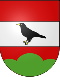
Crésuz
| Crésuz | |
|---|---|
| State : |
|
| Canton : |
|
| District : | Gruyère |
| BFS no. : | 2130 |
| Postal code : | 1653 |
| Coordinates : | 577 210 / 163052 |
| Height : | 909 m above sea level M. |
| Height range : | 798–1397 m above sea level M. |
| Area : | 1.79 km² |
| Residents: | 382 (December 31, 2018) |
| Population density : | 213 inhabitants per km² |
| Website: | www.cresuz.ch |
| Location of the municipality | |
Crésuz ( Freiburger Patois ) is a municipality in the Gruyère district of the canton of Friborg in Switzerland . The former German name Kürjü is no longer used today.
geography
Crésuz lies at 909 m above sea level. M. , 6.5 km east of the district capital Bulle (linear distance). The former farming village extends on the southern slope of Mont Bifé on a terrace above the Lac de Montsalvens reservoir , in the wide valley of Charmey in the Freiburg Pre-Alps .
The area of the 1.8 km² municipal area covers a section of the pre-Alpine area in the southern part of the canton of Friborg. The former course of the Jaunbach (French: Jogne) in the area of the Lac de Montsalvens reservoir forms the southern border of the area. To the east, the border follows along the Javro River , which in its lowest part has also been dammed into a narrow stagnant body of water by the Lac de Montsalvens. From the lakeshore, the communal soil extends north-west up the slope over the terrace of Crésuz and the Tremblex forest to the Petits Monts and Gros Monts alpine pastures . Above Gros Monts is 1396 m above sea level. M. reached the highest point of Crésuz. The stream that rises here and flows into the Lac de Montsalvens forms the western border. In 1997, 18% of the municipal area was settled, 34% forest and woodland, 39% agriculture and a little less than 9% was unproductive land.
Crésuz includes holiday home areas above the village as well as a few individual farms and alpine huts. The neighboring communities of Crésuz are Broc , Châtel-sur-Montsalvens and Val-de-Charmey .
population
With 382 inhabitants (as of December 31, 2018), Crésuz is one of the small communities in the canton of Friborg. 77.3% of the residents are French-speaking, 18.3% German-speaking and 1.8% Portuguese-speaking (as of 2000). The population of Crésuz was 111 inhabitants in 1850 and 127 in 1900. After a peak around 1920 (177 inhabitants; numerous residents worked in the Cailler chocolate factory in Broc), the population decreased by almost 40% to 108 people by 1970 due to strong emigration. Especially during the 1980s, a rapid population increase (doubling of the population) was recorded.
economy
Until the second half of the 20th century, Crésuz was a predominantly agricultural village. Today, livestock and dairy farming are only of minor importance in the employment structure of the population. Further jobs are available in local small businesses and in the service sector. In the last few decades the village has also developed into a residential community thanks to its attractive location. Many people in employment are therefore commuters who work in the Bulle or Freiburg regions. With the construction of numerous holiday apartments, Crésuz, as the neighboring community of Charmey, has experienced a tourist boom since the 1960s.
traffic
The community is very well developed in terms of traffic. It is located on the main road from Bulle over the Jaunpass to Boltigen . Crésuz is connected to the public transport network by the Transports publics Fribourgeois bus routes , which run from Bulle to Boltigen and from Freiburg via La Roche to Jaun .
history
The first written mention of the place took place in 1301 under the names Cresu and Crisu . The origin of the place name is not clearly established. Crésuz is derived either from the Latin word croceolus (small lamp) or from cressa (elevation, hill). Since the Middle Ages, Crésuz was under the lords of Corbières and was part of the Charmey rulership.
Together with the dominion of Corbières, the village was bought in 1454 by the county of Gruyères . The financial difficulties of Count Michael von Gruyères led to the sale of the dominion of Corbières to Freiburg in 1553, which established the Bailiwick of Corbières. In 1667 numerous houses fell victim to a fire. After the collapse of the Ancien Régime (1798), Crésuz belonged to the district of Gruyères during the Helvetic period and from 1803 to the arrondissement of Charmey, before being reintegrated into the district of Gruyères in 1815.
Since 2012, the community has been part of the Parc naturel régional Gruyère Pays-d'Enhaut .
Attractions
The parish church of Saint-François von Crésuz was consecrated in 1647, but burned down 20 years later in the village fire. In 1670 the church was rebuilt. Characteristic groups of houses from the 18th century have been preserved in the town center.
Web links
- Website of the municipality of Crésuz (French)
- Marianne Rolle: Crésuz. In: Historical Lexicon of Switzerland .
- Aerial views of the village
Individual evidence
- ↑ Permanent and non-permanent resident population by year, canton, district, municipality, population type and gender (permanent resident population). In: bfs. admin.ch . Federal Statistical Office (FSO), August 31, 2019, accessed on December 22, 2019 .


