
La Roche FR
| FR is the abbreviation for the canton of Friborg in Switzerland and is used to avoid confusion with other entries of the name La Roche . |
| La Roche | |
|---|---|
 |
|
| State : |
|
| Canton : |
|
| District : | Gruyère |
| BFS no. : | 2149 |
| Postal code : | 1634 |
| Coordinates : | 576 988 / 171700 |
| Height : | 747 m above sea level M. |
| Height range : | 674–1719 m above sea level M. |
| Area : | 24.06 km² |
| Residents: | 1711 (December 31, 2018) |
| Population density : | 71 inhabitants per km² |
| Website: | www.la-roche.ch |
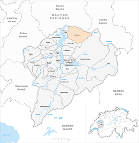
| Location of the municipality | |
  |
|
La Roche ( Freiburger Patois ) is a municipality in the Gruyère district of the canton of Friborg in Switzerland . The former German name Zurflüh is no longer used today.
geography
La Roche is 747 m above sea level. M. , 11 km northeast of the district capital Bulle (linear distance). The street village extends in the valley of the Serbache brook , a right side brook of Lake Gruyère , at the western foot of the Berra , in the Freiburg Alpine foothills .
The area of the 24.0 km² municipal area comprises a section of the pre-alpine landscape at the foot of the Berra. The western part of the municipality is occupied by the valley of the Serbache, which rises with numerous source streams on the western slope of La Berra and Cousimbert. The Serbache flows into Lake Gruyère, of which only a small part in the mouth of the stream belongs to La Roche. To the north of the Serbache valley, the municipality extends to the forest hill La Combe ( 1082 m above sea level ). A large part of the mostly densely forested western slope of the flysch mountains La Berra (at 1719 m above sea level, the highest elevation in the municipality) and Cousimbert ( 1633 m above sea level ) lies in the area of La Roche. The slope is subdivided by different valleys. A small portion of the community area lies beyond the ridge of the Cousimbert in the Plasselbschlund , the source area of the Ärgera . In 1997, 4% of the municipal area was in settlements, 47% in forests and woodlands, 47% in agriculture and a little less than 2% was unproductive land.
La Roche includes the settlements of Le Villaret ( 740 m above sea level ) southwest, Le Tsubel ( 760 m above sea level ) and La Serbache ( 778 m above sea level ) northeast of the village in the valley of the Serbache, Sur Montsoflo ( 950 m above sea level ) on the western slope of the Berra as well as numerous individual farms. Neighboring municipalities of La Roche are Pont-la-Ville , Treyvaux , Le Mouret , Plasselb , Val-de-Charmey and Hauteville .
population
With 1711 inhabitants (as of December 31, 2018), La Roche is one of the medium-sized municipalities in the canton of Friborg. 92.5% of the residents are French-speaking, 3.5% German-speaking and 2.4% Portuguese-speaking (as of 2000). The population of La Roche was 1081 in 1900. During the 20th century it commuted between 1000 and 1130 people. Only since 1980 (1027 inhabitants) has a significant increase in population been recorded.
economy
Up until the second half of the 20th century, La Roche was a predominantly agricultural village. Even today, livestock and dairy farming and, to a lesser extent, arable farming play an important role in the income structure of the population. Further jobs are available in local small businesses and especially in the service sector. Various small businesses such as joiners, carpenters and wood processing companies have set up shop in the village. When there is good snow conditions, several ski lifts are in operation on the western slope of the Berra in winter. In the last few decades the village has developed into a residential community. Many people in employment are therefore commuters who work in the Bulle and Freiburg regions.
traffic
The community is very well developed in terms of traffic. It is located on the main road from Freiburg to Broc . La Roche is connected to the public transport network by the Transports publics Fribourgeois (tpf) bus routes , which run from Freiburg to Bulle and from Freiburg to Jaun . Another line connects the village with Pont-la-Ville.
history
The municipality of La Roche was already settled in Roman times, which was confirmed by finds of Roman coins and jewelry. In the Middle Ages the village was owned by the noble family La Roche, which probably descended from the lords of Corbières and died out in the 14th century. In 1349 the area was bought by the Bishop of Lausanne .
After the conquest of the Vaud by Bern, La Roche came under the rule of Friborg as a former episcopal area in 1537 and, together with the neighboring village of Pont-la-Ville, was assigned to the Bailiwick of Bulle as an exclave. During the French Revolution , Trappists from France settled in the village. After the collapse of the Ancien Régime (1798), the village belonged to the Bulle district during the Helvetic and the subsequent period until 1848, before it was incorporated into the Gruyères district.
Attractions

La Roche has had its own parish since 1656. The church dates from the 17th century and was later restored several times. The Notre-Dame de Compassion chapel was built in 1550 and was an important pilgrimage site in the 17th and 18th centuries. At La Roche there are still ruins of a tower built under Ulrich von Vuippens from the 13th century.
Personalities
- Mathilde Gremaud (* 2000), freestyle skier
- Noémie Kolly (* 1998), ski racer
Web links
- Official website of the municipality of La Roche (French)
- Marianne Rolle: La Roche. In: Historical Lexicon of Switzerland .
- Castle world: Château de La Roche
- Aerial views of the village
Individual evidence
- ↑ Permanent and non-permanent resident population by year, canton, district, municipality, population type and gender (permanent resident population). In: bfs. admin.ch . Federal Statistical Office (FSO), August 31, 2019, accessed on December 22, 2019 .
Bas-Intyamon | Botterens | Broc | Bull | Châtel-sur-Montsalvens | Corbières | Crésuz | Echarlens | Grandvillard | Gruyères | Hauteville | Haut-Intyamon | Jaun | La Roche | Le Pâquier | Marsens | Morlon | Pont-en-Ogoz | Pont-la-Ville | Riaz | Sâles | Sorens | Val-de-Charmey | Vaulruz | Vuadens
Former municipalities: Albeuve | Avry-devant-Pont | Cerniat | Charmey | Enney | Estavannens | Gumefens | La Tour-de-Trême | Le Bry | Lessoc | Maules | Montbovon | Neirivue | Romance | Rueyres-Treyfayes | Villarbeney | Villars-d'Avry | Villars-sous-Mont | Villarvolard | Vuippens
Canton of Friborg | Districts of the canton of Friborg | Municipalities of the canton of Friborg