
Morlon
| Morlon | |
|---|---|
 |
|
| State : |
|
| Canton : |
|
| District : | Gruyère |
| BFS no. : | 2143 |
| Postal code : | 1638 |
| Coordinates : | 572 980 / 163904 |
| Height : | 751 m above sea level M. |
| Height range : | 674–830 m above sea level M. |
| Area : | 2.64 km² |
| Residents: | 615 (December 31, 2018) |
| Population density : | 233 inhabitants per km² |
| Website: | www.morlon.ch |
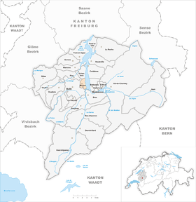
| Location of the municipality | |
  |
|
Morlon ( Freiburger Patois ) is a municipality in the Gruyère district of the canton of Friborg in Switzerland . The former German name Morlung is no longer used today.
geography
Morlon lies at 751 m above sea level. M. , 2.5 km east-northeast of the district capital Bulle (linear distance). The street row village extends on a promontory in a panoramic location around 80 m above the west bank of Lake Gruyère , in the Gruyère region at the northern foot of the Alps.
The area of the 2.5 km² large municipal area (with the lake area 4.2 km²) comprises a section of the Bulle basin in the foothills of the Friborg Alps . In the east, Morlon has a large share of the southern section of Lake Gruyère; the area extends to the confluence of the Saane (French: Sarine). From the lakeshore with the Laviaux peninsula , the community grounds extend westward over the terrace of Morlon to the height of Vaucens , on which at 831 m above sea level. M. the highest point of the municipality is reached. In the south, the area extends into the valley floor of a stream that rises in the Bois de Bouleyres forest . In 1997, 8% of the municipal area was in settlements, 14% in forests and woodland, 75% in agriculture and a little less than 3% was unproductive land.
Morlon includes new single-family housing estates on the western edge of the village as well as some individual farms. The neighboring communities of Morlon are Bulle , Echarlens , Botterens and Broc .
population
| Population development | ||||||||||||||
|---|---|---|---|---|---|---|---|---|---|---|---|---|---|---|
| year | 1811 | 1850 | 1900 | 1920 | 1950 | 1970 | 2000 | 2010 | 2012 | 2014 | 2017 | |||
| Residents | 252 | 278 | 295 | 401 | 334 | 301 | 480 | 595 | 588 | 587 | 595 | |||
With 615 inhabitants (as of December 31, 2018), Morlon is one of the smaller communities in the canton of Friborg. 93.3% of the residents are French-speaking, 2.9% German-speaking and 1.0% English-speaking (as of 2000). The population of Morlon was 278 in 1850 and 295 in 1900. Thereafter, the population increased further to 401 people by 1920, and then decreased by 25% to 301 people by 1970. Since then, the population has grown rapidly.
economy
Until the second half of the 20th century, Morlon was predominantly an agricultural village. Even today, livestock and dairy farming and, to a lesser extent, arable farming play an important role in the income structure of the population. Further jobs are available in local small businesses and especially in the service sector. In the last few decades the village has also developed into a residential community thanks to its attractive location. Most of the employed are therefore commuters who work in the Bulle and Freiburg regions.
traffic
The community is located off the main thoroughfares, but can be easily reached from Bulle . The next connection to the A12 motorway , which has been open continuously from Bern to Vevey since 1981 , is around 5 km from the town center. The village is connected to the public transport network by the Transports publics Fribourgeois bus route from Bulle to Morlon.
history
The municipality of Morlon was settled very early. A prince's grave from the Hallstatt period is believed to be under a regular hill on the edge of the forest in Vaucens . The place was first mentioned in a document in 995 under the name Molas subteriores . The names Mollon (1038) and Mollun (1264) appeared later , and the current name has been passed down since 1500.
Part of the village came to the Saint-Maurice Abbey in 1038 by barter . The Premonstratensian monastery of Humilimont also owned land near Morlon. Morlon was part of the county of Gruyères from the early 13th century . At the beginning of the 14th century, the village came under the rule of Vuippens and later to the rule of Everdes. In 1475 it came with this to Freiburg and belonged to the Vogtei Vuippens-Everdes from 1553 to 1798. After the collapse of the Ancien Régime , Morlon belonged to the then Bulle district during the Helvetic Republic and the subsequent period until 1848, before it was incorporated into the Gruyères district. The village suffered several severe fires, particularly during the 19th century (1845, 1891 and 1900).
Attractions
On the northeastern edge of the village stands the Saint-Grat church, which was originally built at the end of the 15th century and later renovated several times. In the old town center some characteristic farmhouses from the 19th century have been preserved.
Personalities
- Pierre Tobie Yenni (1774–1845), Bishop of Lausanne-Geneva
Web links
- Official website of the municipality of Morlon
- Aerial views of the village
- Alain-Jacques Czouz-Tornare: Morlon. In: Historical Lexicon of Switzerland .
Individual evidence
- ↑ Permanent and non-permanent resident population by year, canton, district, municipality, population type and gender (permanent resident population). In: bfs. admin.ch . Federal Statistical Office (FSO), August 31, 2019, accessed on December 22, 2019 .
- ↑ Alain-Jacques Tornare Czouz-: Morlon. In: Historical Lexicon of Switzerland . 2009 .
Bas-Intyamon | Botterens | Broc | Bull | Châtel-sur-Montsalvens | Corbières | Crésuz | Echarlens | Grandvillard | Gruyères | Hauteville | Haut-Intyamon | Jaun | La Roche | Le Pâquier | Marsens | Morlon | Pont-en-Ogoz | Pont-la-Ville | Riaz | Sâles | Sorens | Val-de-Charmey | Vaulruz | Vuadens
Former municipalities: Albeuve | Avry-devant-Pont | Cerniat | Charmey | Enney | Estavannens | Gumefens | La Tour-de-Trême | Le Bry | Lessoc | Maules | Montbovon | Neirivue | Romance | Rueyres-Treyfayes | Villarbeney | Villars-d'Avry | Villars-sous-Mont | Villarvolard | Vuippens
Canton of Friborg | Districts of the canton of Friborg | Municipalities of the canton of Friborg